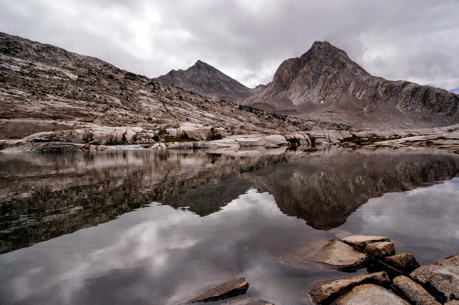
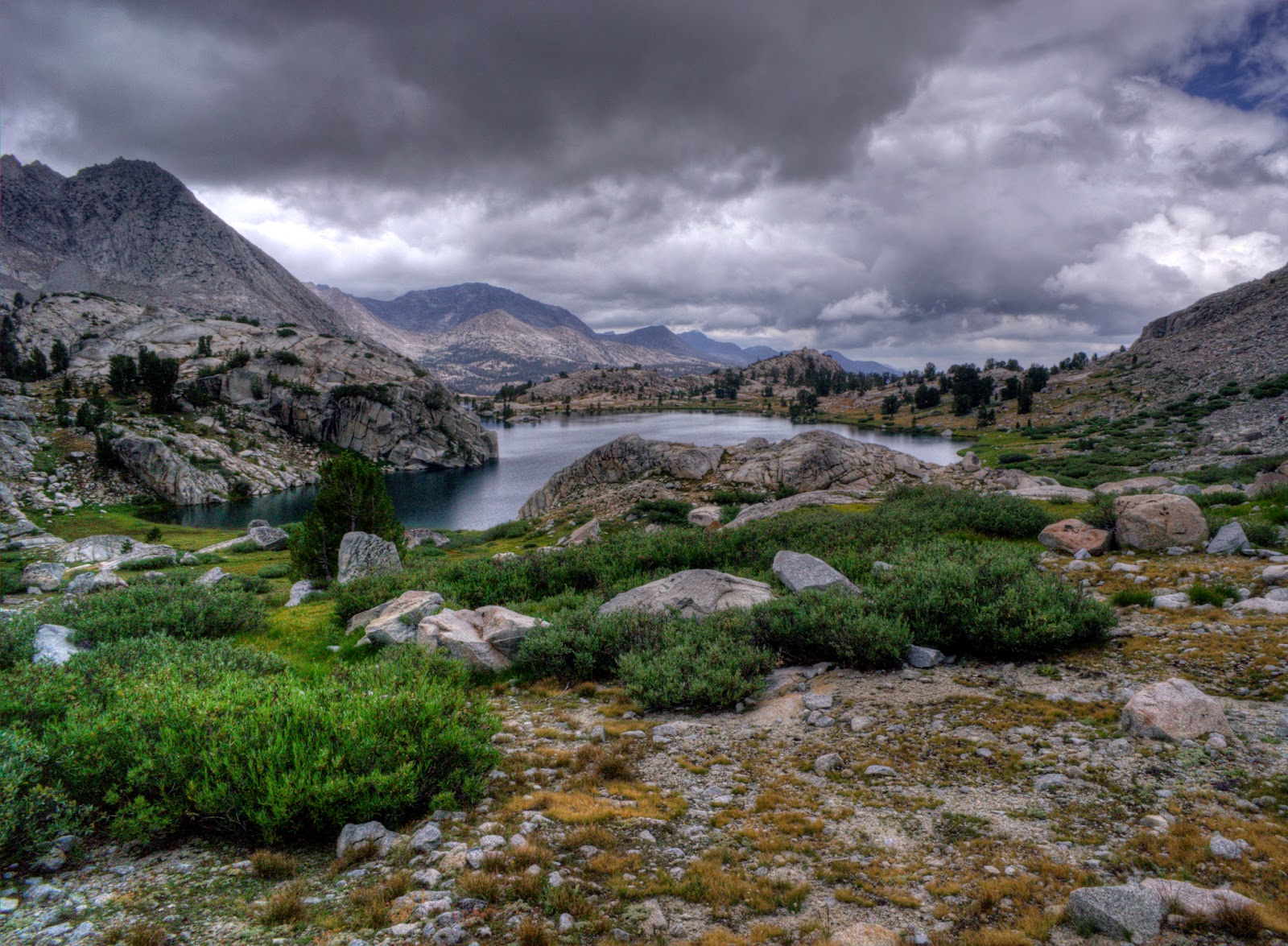
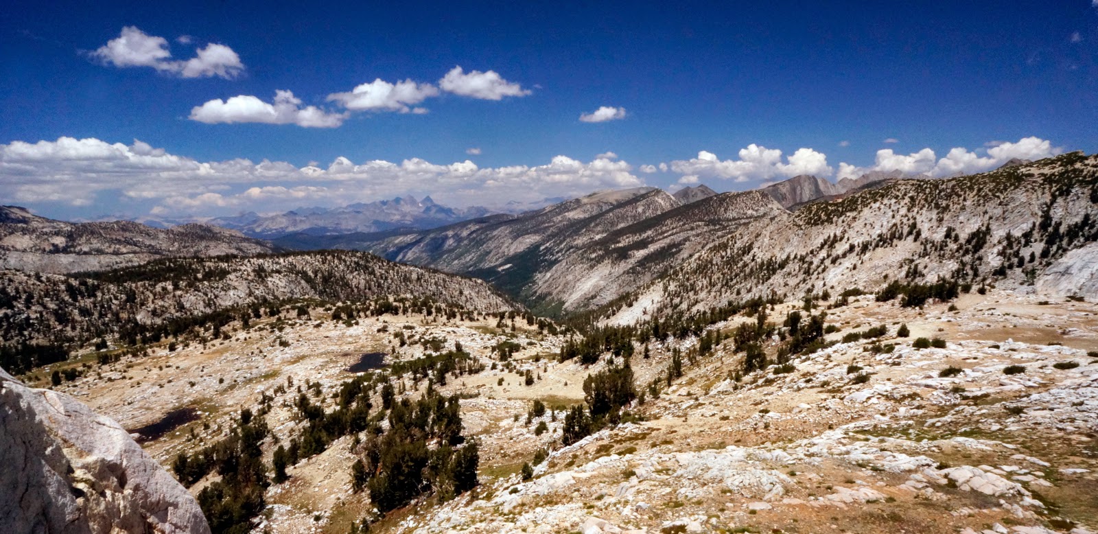
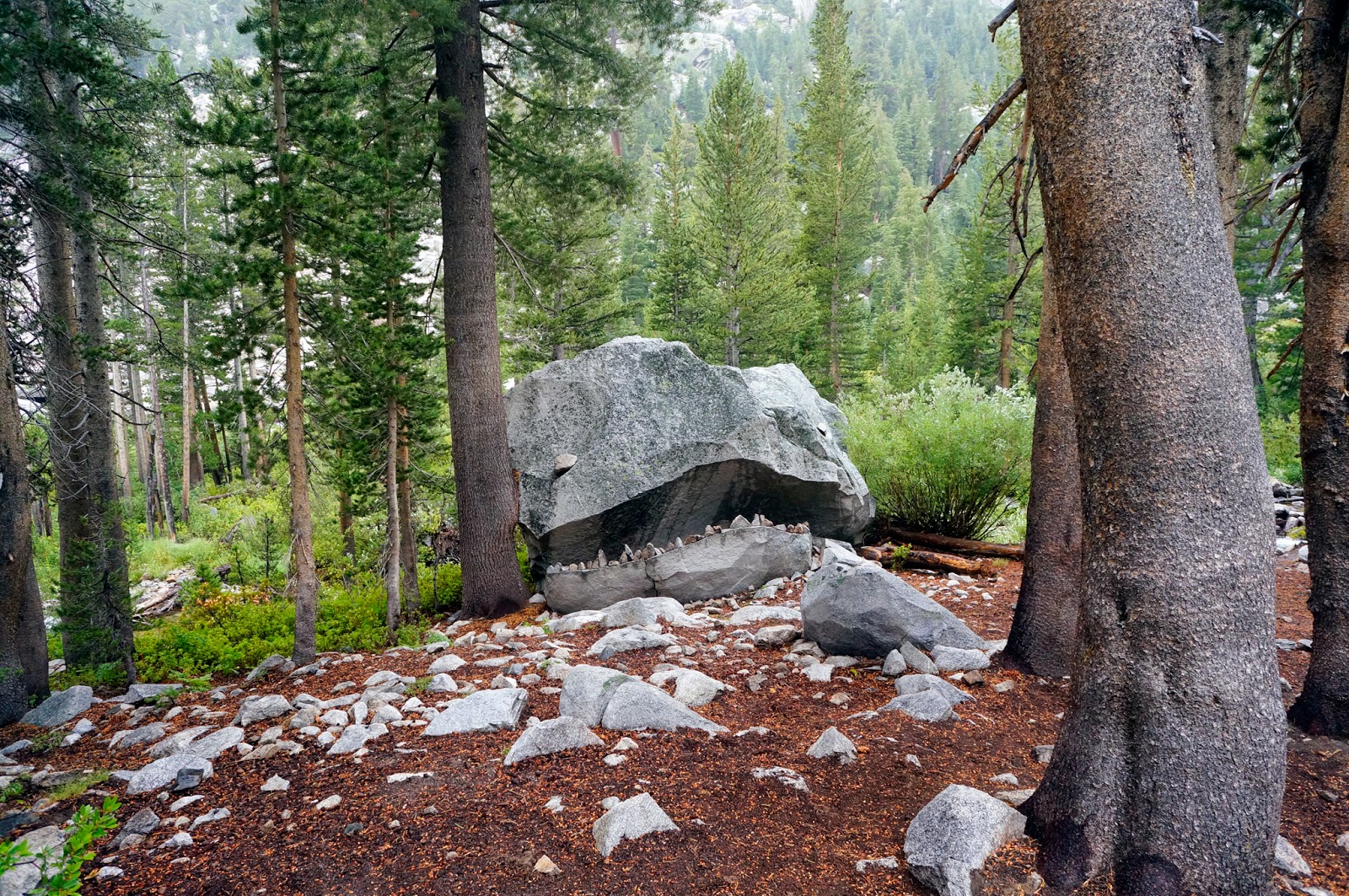
Days 0-6 | Onion Valley to Bishop Pass | 79 miles
As my dramatic farewell to California, the state that had been my home for 6 years in grad school and that I had claimed as home while living as a nomad in this year following my graduation, I spent just over two weeks hiking the
John Muir Trail. Alone. It was one of the best adventures I've ever had and an experience I'll treasure forever.
This is Part I in a multi-part series. Stay tuned for the rest!
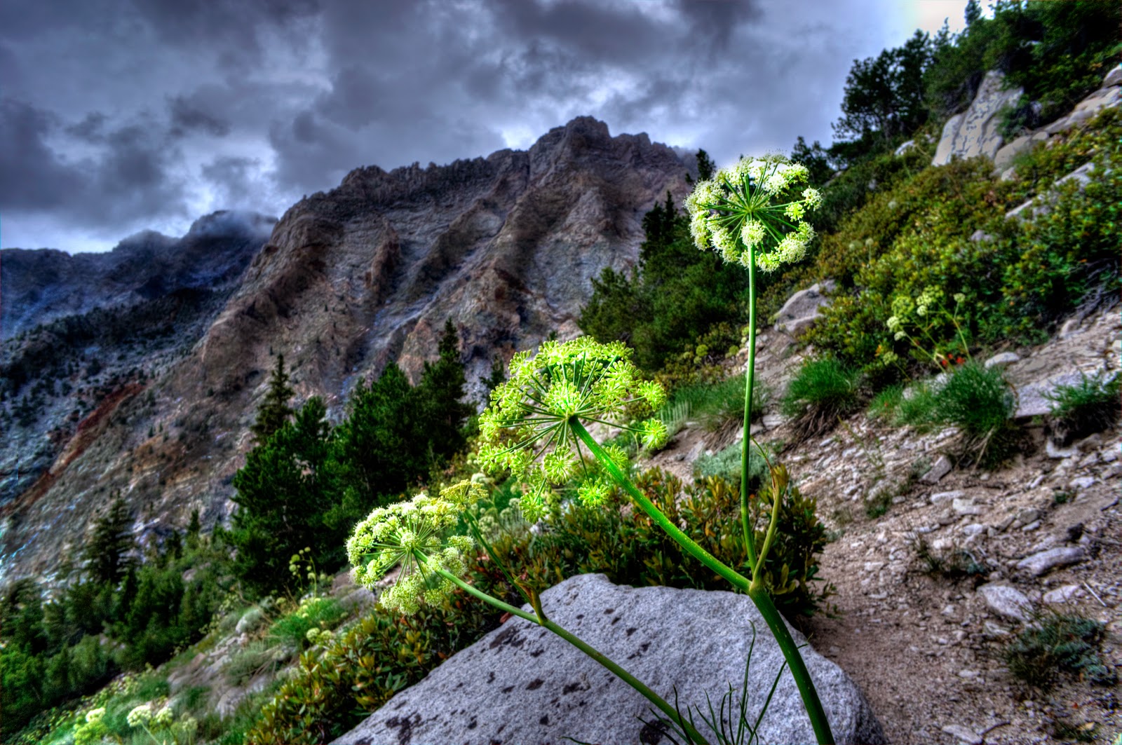 |
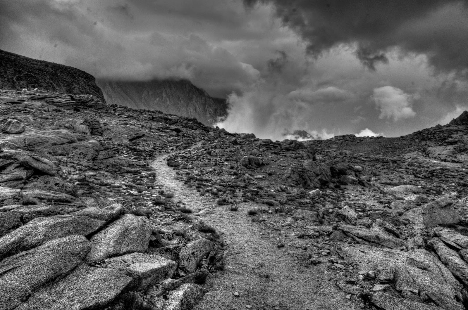
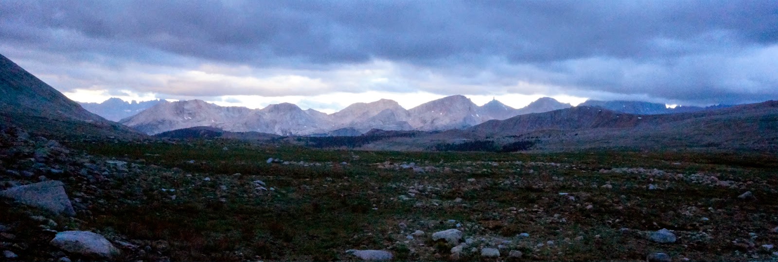
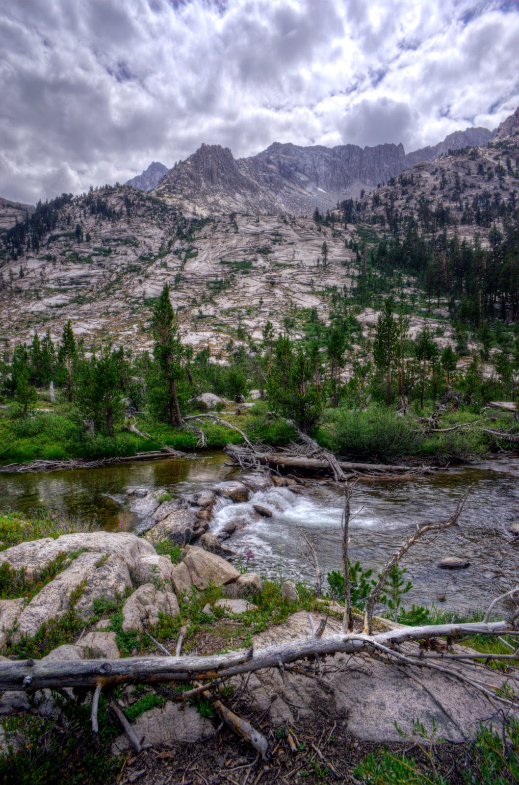
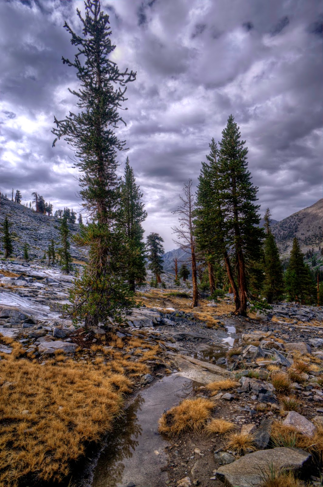
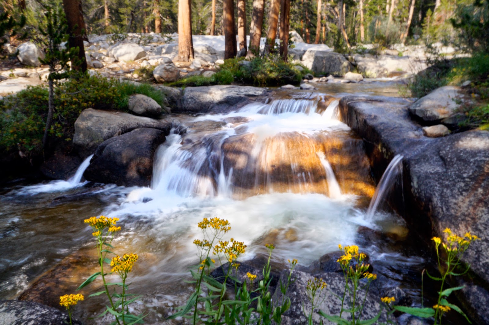
| Flowers brightening a dark and stormy climb up Shepherds Pass in the Eastern Sierra |
Why the JMT
After a fun summer of science, I was desperately missing the mountains. Before I started back up with my new responsible life as an employed person, I wanted to get out and do some serious backpacking.
As John Muir himself put it (he has the best
mountain quotes):
Keep close to Nature's heart... and break clear away, once in a while, and climb a mountain or spend a week in the woods. Wash your spirit clean.
This was all just a vague idea until I realized that summer was quickly slipping away and that if I wanted to do something, I needed to get on it. But where? I was in L.A. splitting time between the research station on Catalina island, my friend Vicky's couch, and a tent in my PhD advisor's yard as I finished up some research work and needed to drive north to Seattle to find a place to live. So somewhere on the way was an obvious choice. I've loved the Eastern Sierra ever since I went on a short overnight backpacking trip in them with my sister the weekend after moving to L.A., so that seemed like a good place to start. But I didn't want to go out for a weekend, I wanted to for a week or maybe a bit longer, as that's about all I had time for. Having grown up on the
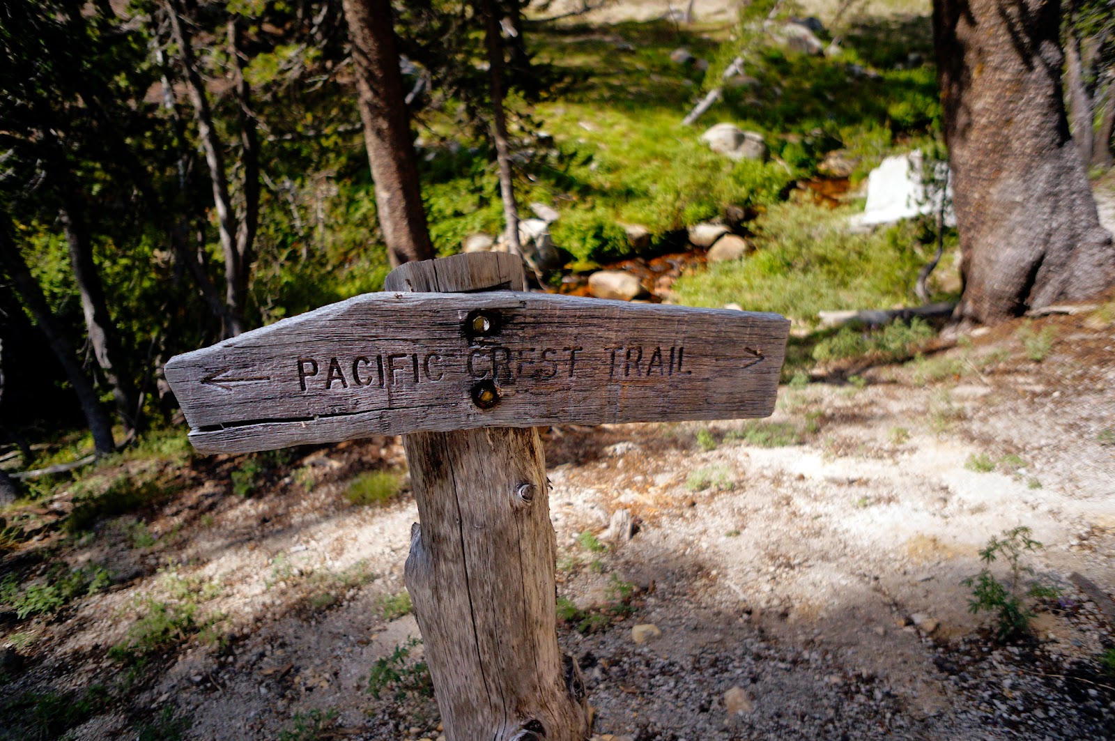
Pacific Crest Trail in Washington's Cascade Mountains, I thought maybe a scenic Sierra section of the PCT would be good. Then I remembered hearing about the John Muir Trail as being spectacular, so I looked it up. 211 miles (340 km) through three national parks (
Yosemite,
King's Canyon, and
Sequoia), plus the
John Muir and
Ansel Adams Wildernesses? Um, yes please.
 |
| Glamping in my PhD advisor's yard in Pasadena the week before taking off |
How far is 211 miles again? I wanted to go for fun and relaxation, not masochism, so I figured an average of 12 miles/day plus one day a week to go climb a side mountain or sit around and fish at a perfect little alpine lake was a good schedule. That made for a nice round three weeks. Quite a bit longer than I was thinking, but once I had the JMT idea in my head, it needed to happen. That meant I'd have to be on the trailhead in less than a week.
Thus commenced a frantic several days of procuring
permits (no Yosemite or Whitney permits available, but there were a few left at various
other access points), maps, gear (after having just spent a good chunk of my year of funemployment
backpacking, you'd think I
would have had everything I needed, but REI still managed to punch my credit card), and food and taking care of important business like shipping out resupply boxes (to my sister: "Here Bean, I'm going to be way the hell out in the mountains for three weeks, come feed me") and re-learning how to fish (in what was perhaps my PhD advisor's most adorable parenting moment ever). Here is the rest of the story.
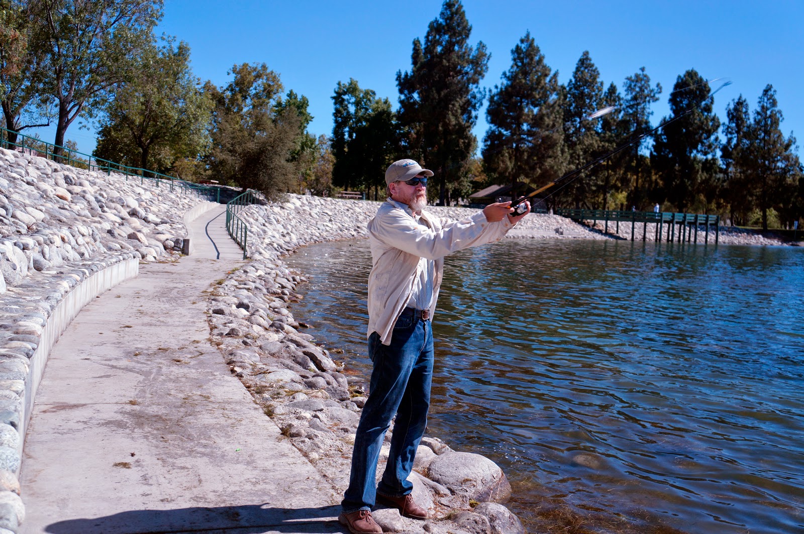 |
| Frank, demonstrating casting |
 |
| Me, blow-drying a fly |
But is it safe?
A lot of people who care about me were concerned about me doing it alone. I wasn't. After my year of
solo-traveling South America, a hike in the mountains seemed, well, about as scary as going back home after the end of a long day. Except with bears. I was kind of illogically nervous about bears, but it all worked out for me and the bears. More on that later.
A lot of people worry that (1) hiking alone isn't safe, and (2) doing anything alone as a woman isn't safe.
On Point 1, the first rule of doing outdoor stuff that I break all the time is to never go alone. It's always good to have a buddy for safety when doing things. But the JMT is a very busy trail and hiking it south to north, I knew that, unlike
other solo hikes I've done, I'd be seeing dozens of people every day (in reality, I usually saw 70-120 people/day, even in the most remote sections) who could help me out if I got into serious trouble. And I'd always be about a day's hike from places with cell phone reception or means of contacting the outside world.
To me, the rewards of solo adventuring (or adventuring period--it's hard enough to find people to do things even for a weekend trip) far outweigh the risks. Lots of people solo hike. Solo hiking is fun, peaceful, and an incredibly rich experience.
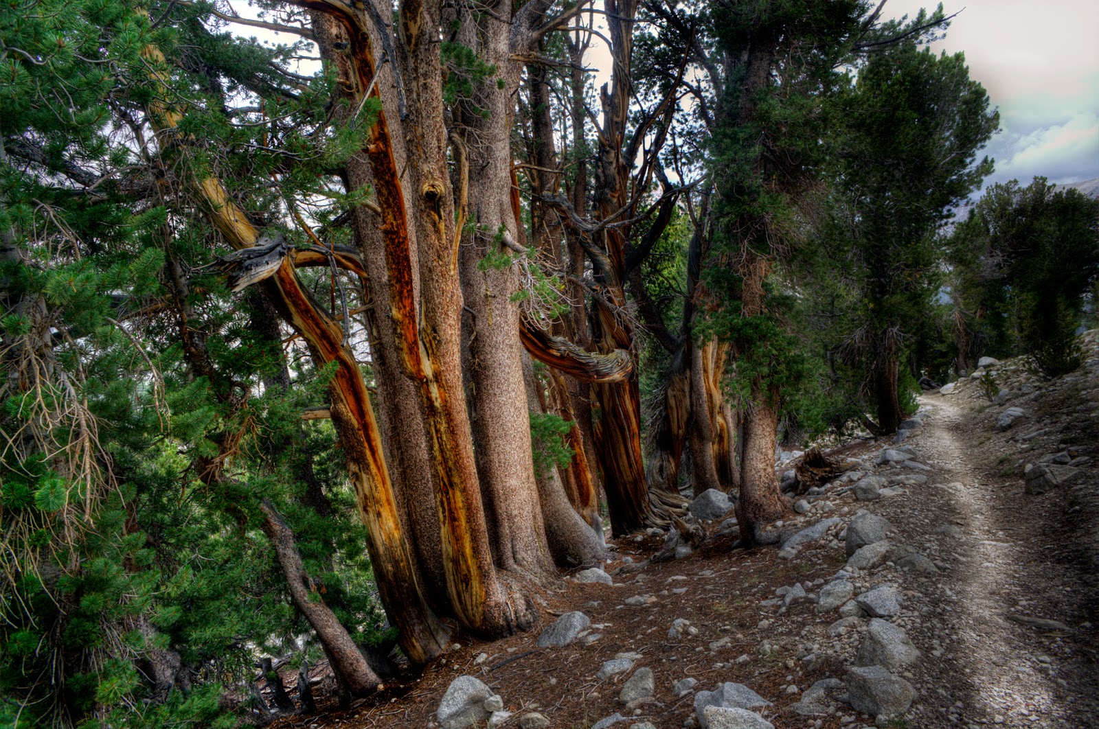 |
| Beautiful trees along the trail, best appreciated in the silence of solitude. |
Point 2, that it's dangerous for a
woman pisses me off for two reasons.
First, it suggests that, as a woman, I'm fragile and less capable of long-distance hiking than a man. That's a
big pile of steaming horse shit. When it comes to backpacking, women are not at any significant physical disadvantage vs. men. Women are also no more likely to fall off a cliff, get mauled by a bear, get struck by lightning, or get blisters than a man. Women were involved in pioneering long-distance trails in the U.S. Women set
speed records on the Pacific Crest Trail. The guidebook used by almost everyone on the JMT was researched and written by a
woman.
Second, it comes with the idea that any woman out in the woods alone is going to get raped, killed, and probably both, and that's a problem unique to women. It pisses me off that that's even something that people think to worry about, that violence and sexual violence against women--against
anyone--ever happens. But this is a silly thought when you look at the statistics. You know one thing nobody would ever caution me against that is more likely to get me killed than some backwoods psycho? Pregnancy. "Don't get pregnant! You might
die!"
 |
| Solitary flower in a big, scary world |
There's this image of a lone woman in a sea of sexually ravenous macho mountain men. The reality is a lot different. The thousands of men (and women) I interacted with on the trail treated me like...a hiker, and therefore an insta-friend, part of the big Hiker Family. It was a refreshing change from how I'm often treated in the city. Mountain people are good people. They look out for each other and help each other out. While I have met plenty of bad apples in my time on Earth, I have yet to meet an exception to the Mountain People are Good People rule...at least when they are in the mountains. My mom feels more comfortable when I'm out alone in the mountains than when I'm home in the city because she knows I'm safer there.
Women do this sort of thing--and love it--all the time. I saw solo women hikers of all ages from early 20s to late 80s
every day on the JMT. And they all had big smiles on their faces. So if you're reading this as a woman thinking about doing the trail, or any trail, or any adventure, but nervous about doing it alone, DO IT. It'll change your world. If you're a family member or loved one, your girl will be fine, and is likely to have a powerful experience that will make her stronger, more empowered, and therefore safer when she returns to the real world.
Note on the JMT Slayer Variant
Before anyone gets their panties in a knot, I did not hike the John Muir trail in its entirety as it is officially determined. Since I couldn't get a Whitney permit, I started at
Shepherd Pass, the first access trail to the JMT north of it's terminus at
Whitney Portal. On my journey to the trailhead I was told that Shepherd Pass is the "hardest hike in the Eastern Sierra" three different times by three different people. I did not climb Mt. Whitney (I'll do that one of these days when I can get a permit), so I skipped the southern 16.5 miles of the official trail (really, 26.9 miles since I'm pretty sure nobody has ever actually started their trek from where the trail officially starts on the summit of Mount Whitney). Instead, I hiked the 14 miles and 6733 ft of climbing (for 5933 ft of elevation gain to the pass at 12033 ft vs. 6137 ft of climbing for the Mt. Whitney trail).
From Tom's Hiking Pages page on the "
Four Nasty Passes":
One of the more dreadful east-side approaches in the range. The ascent from desert to alpine zone is an interminable ordeal of dryness and steepness. A 500 foot descent midway is a classic destroyer of morale, regardless of the direction one is travelling.
 |
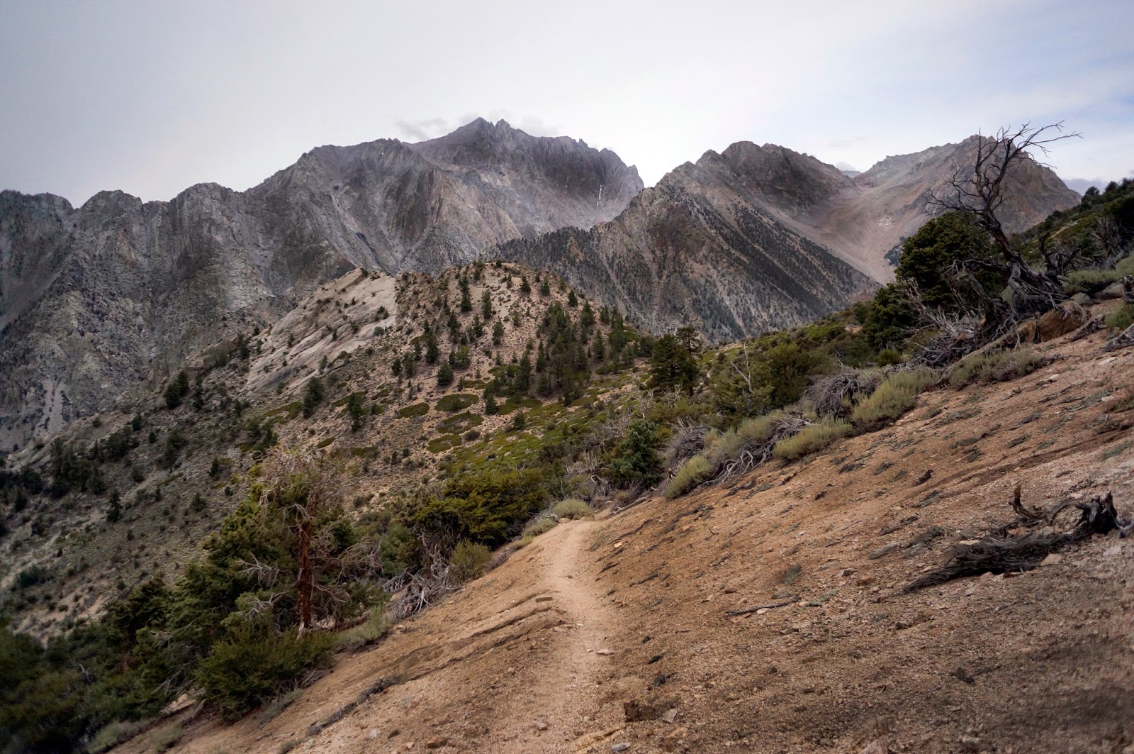
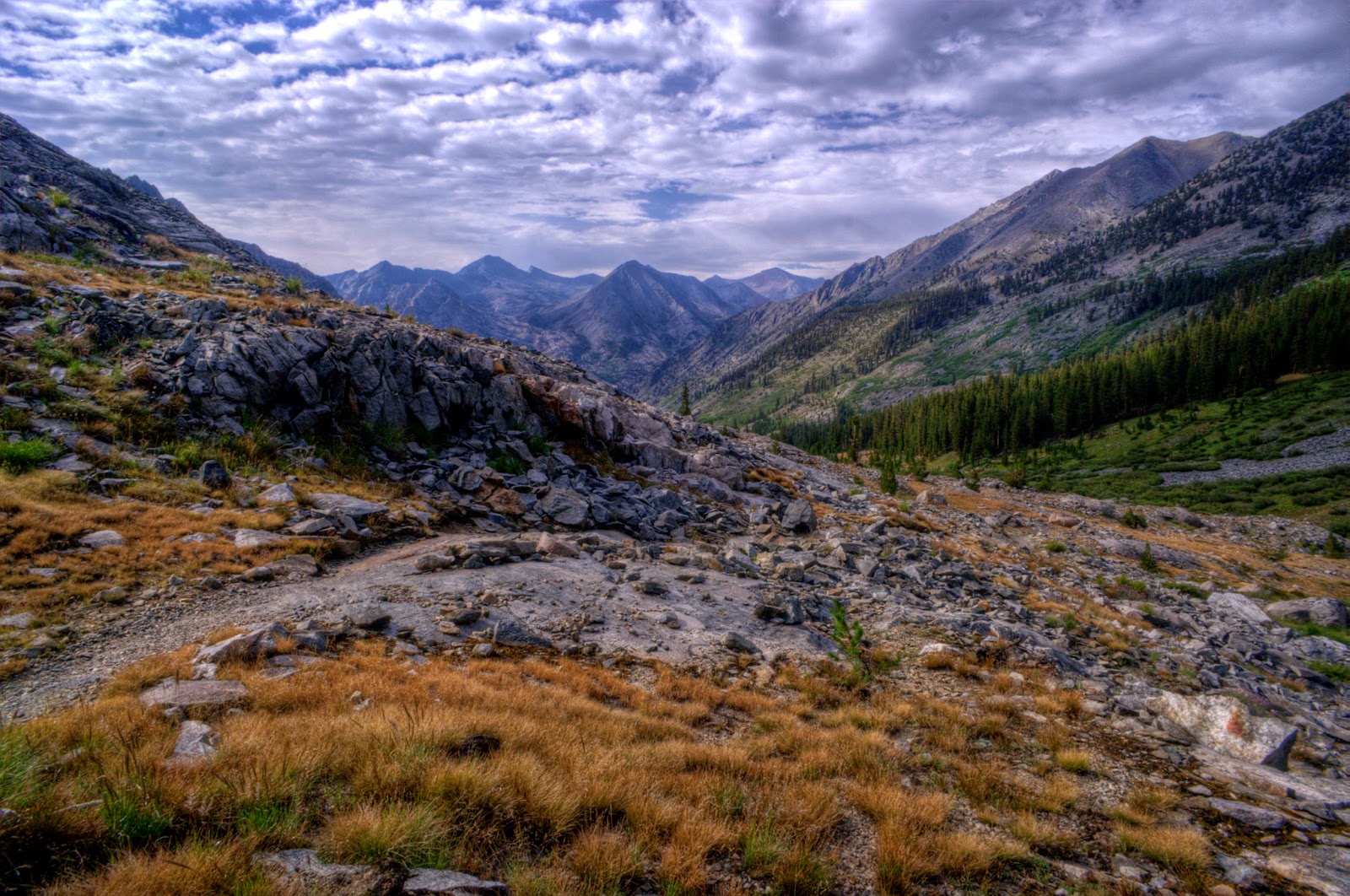
| Shepherds Pass, viewed from the West |
From there, I followed the JMT for the hundred plus miles into Yosemite (with a side trip to
Dusy Basin and other short detours) where I jumped back off of it: instead of following the Lyell Canyon, Tolumne Meadows, Sunrise, and Little Yosemite Valley route, I hid from the crowds by looping around to
Vogelsang,
Merced Lake,
Cloud's Rest, then rejoining the trail for the final few hours after
Half Dome.
Why south to north? First, permits were easier (not starting at Whitney, that is). Second, I was moving north, so hiking north just felt
right. Thirdly, for me, starting in the familiar Eastern Sierra and ending in a place I'd never been before (Yosemite Valley) was like a buildup to a giant reveal. Fourth, I like getting the hard part over with first. Butt was immediately and quickly kicked into shape in the first few days, the rest was easy by comparison. I loved it. The only disadvantage: since the overwhelming majority of people do it north to south, you cross a
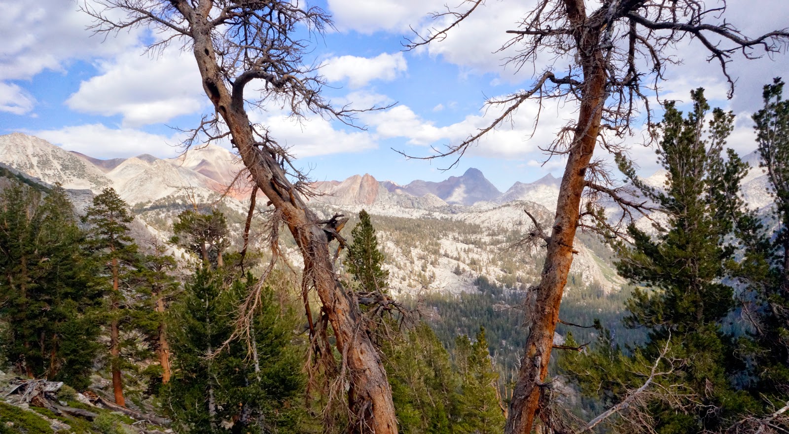
lot of people. Almost every day on the JMT, I passed at least 50, often more like 70-120 people. And it got busier and busier going north. But the people were great and since they were spread out in clumps of groups there were several hour stretches each day where I saw nobody, so it didn't seem as bad as I thought it might.
I'll post the numbers once I've run them, but my route was longer with more climb than the full JMT, I was on the JMT for over 80% of it, and the parts where I wasn't on the JMT were similar in spectacle to their JMT equivalents, so I don't feel like I'm cheating by saying that I hiked the JMT. But if you want to get technical, I hiked the Slayer-JMT. You'll find out what that means if you keep reading.
Day 0: Getting to the trailhead
370 miles by car
Start: Pasadena, CA
End: Shepherd Pass Trailhead via Bishop
After saying goodbye to the people who had become my California Family (which was sad, but not as sad as I thought it would be, feeling more like a "Hug! See you at Thanksgiving!" since once family, always family), I got in my beloved Tomatomobile and headed north. I was so excited about the adventure ahead that I got lost on my way out of the L.A. basin, missing the highway 14 turnoff. It was a good 45 minutes before I realized my mistake. This set me way behind schedule, and I squeaked into the
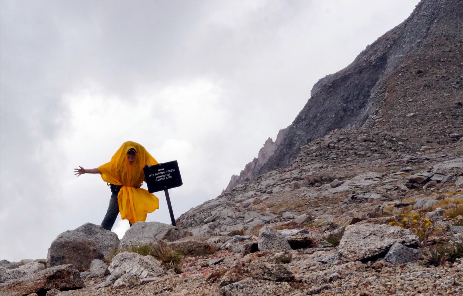
Lone Pine visitor center two minutes before closing to pick up my permit; the office closes at 5 and I had to drive, er, somewhat above the speed limit in order to get there before they closed, only to be met at the gate by a grumpy ranger who didn't want to let me in and insisted that I had to be there by 4:30 to pick up permits. My mom was a forest ranger and I know how frustrated she'd get when people would show up at the last possible minute. So I felt bad and had started out apologetic, but when he said 4:30 I got mad and started arguing about how it says nowhere on the permit reservation that you have to be there half an hour before close. He relented, probably because I was going to be more of a pain in his ass if he let me through than if he didn't, and the attractive young ranger manning the desk got me my permit and out the door in five minutes as a family inside leisurely continued to browse the gift shop. Whew. The ranger did warn me though, "Shepherds? Whew. Get an early start. Hardest hike in the Eastern Sierra."
Then I had to figure out how to get from Bishop, where I was going to park my car at the house of family friends who were out of town, to the trailhead. I ended up finding a shuttle service, and the guy picked me up in Bishop that evening after I'd done a grocery run for some jerky and had my Last Meal (some excellent Mexican) and drove me out to the trail for a painful $100. He was a total character who entertained me with stories during the hour and a half ride. One of his more benign comments: "You don't look like a gal who eats that powder stuff. No offense. I like big women." (did you just call me fat?? was that a creepy come-on? both at the same time?) But I got there safely, and he knew the area well and was able to give me good info about the trail. "You're starting at Shepherds? Why? Good luck, it's miserable. Oh, and watch out for the washout. Wiped out a big section of the trail. You'll have to climb down to get through it."
I was starting to wonder what I'd gotten myself into.
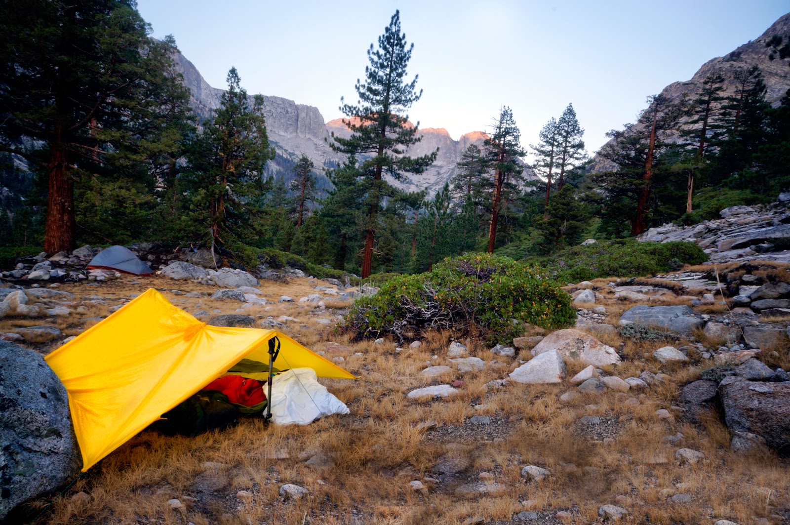
We had driven through an impressive thunderstorm as the sun set, but the clouds controlled themselves once I got to the trailhead and I was able to set up my bivvy for the night in peace. Or rather, semi-peace. It was hot and humid after the rains, but I had to zip the bivvy all the way closed and sweat myself to sleep because there were so many flying ants and other bugs that kept crawling on me.
 |
Camp at the Shepherd Pass trailhead,
the town of Independence down the valley in
the background. |
Day 1: Shepherd Pass
13 miles, 5933' elevation gain, 6733' total climb
Start: Shepherd Pass trailhead (6092')
High Point: Shepherd Pass (12025')
End: Tyndall Creek (11600')
I woke up at around five, having hardly slept that night. I figured it was better to get an early start than stay in bed and try (and fail) to sleep, so I got up and packed up. Although it hadn't rained in the night, my down bag was soaked from sweat and condensation. After checking in with family one last time since I'd been told I wouldn't have cell reception until I got to Red's Meadow a planned 13 days later, I was on the trail at dawn. I was excited, but also a little nervous after all of the warnings about Shepherd Pass. I told myself that if I survived the day, the rest of the trek would be a piece of cake.
 |
| At the trailhead, ready to rock |
It felt great to be on the trail, and I was giddy for it. I saw Steller's jays, birds that looked sort of like gray jays (I'm no ornithologist, but it was light-colored and sounded like a jay), and tons of adorable chipmunks. Later that day I saw marmots, ground squirrels, and more birds, all of them ridiculously adorable. The trail started with several creek crossings in the pretty box canyon of the Symmes Creek drainage, and I filled up on water at what the shuttle driver the night before had said was the last one and my last source of water for several hours (it wasn't). The trail then began to climb, climb, climb up the side of Mt. Begin, and I saw why I had been advised to get an early start as it was dry and exposed and would have been hot and miserable if it hadn't still been early morning. I came to a saddle and stopped for a second breakfast, and since I still had cell reception I sent my mom a note to let her know that I was feeling great and this whole scary day had been terribly overrated. Never say that until you finish.
 |
| On the trail |
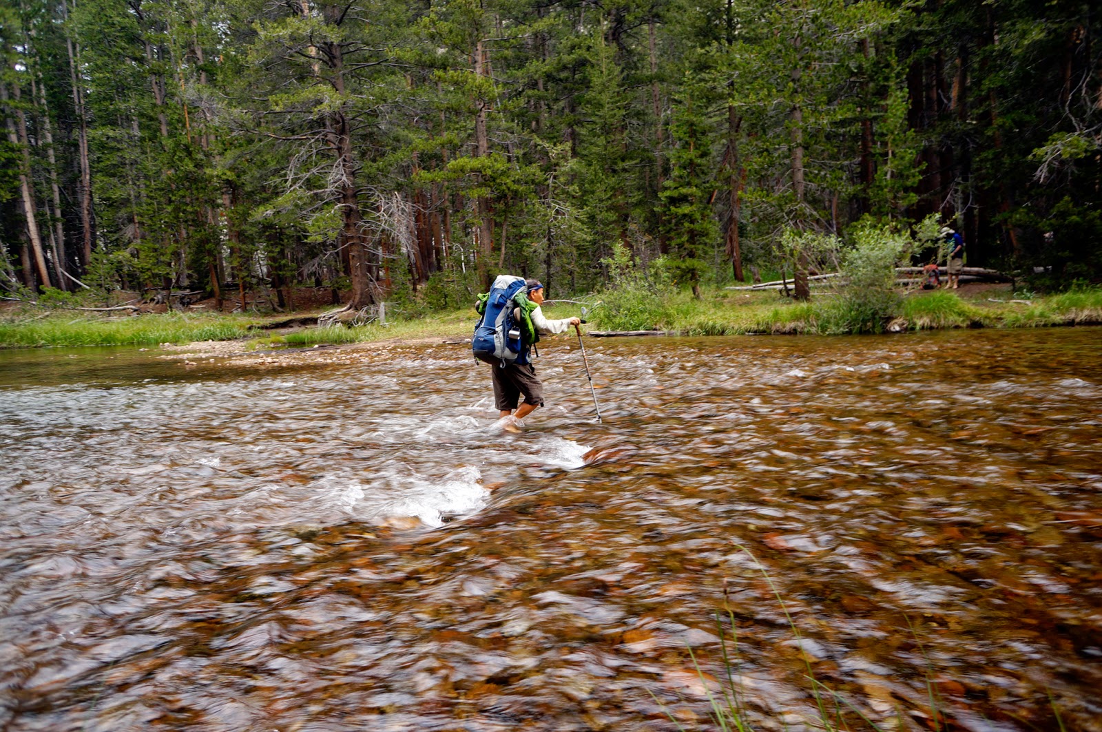
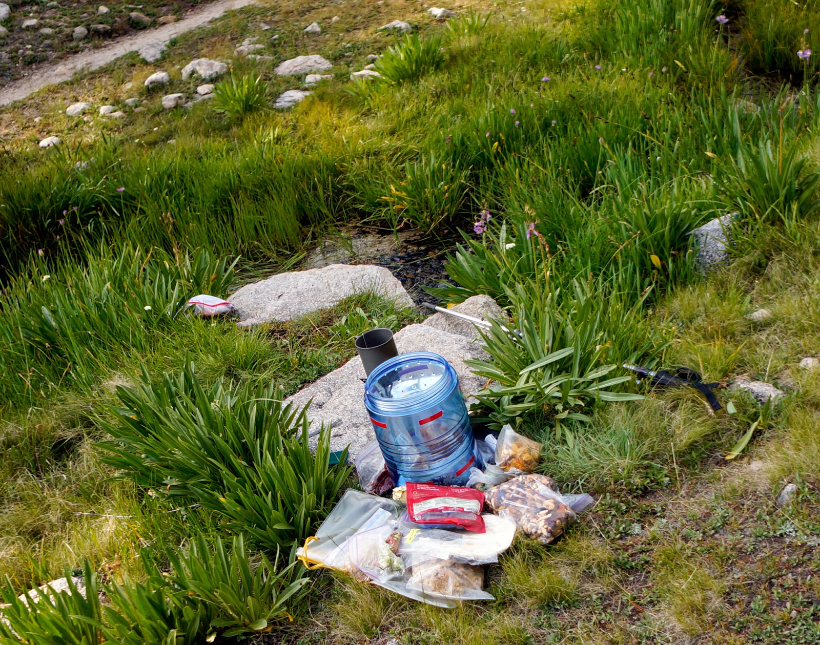
After finishing Second Breakfast (jerky I had dehydrated from leftover steak and trail mix) I continued on, passing a few climbers coming down the mountain. I asked them about the washout and they said it was passable. They also looked at me skeptically when I said I was planning to cross the pass that day and advised I camp below the pass instead. And then the rain started. It was a light rain, but I wasn't eager to get my stuff wet (I had decided not to bring a pack cover since Sierras in the Summer! It's not going to rain...) and was in need of a nap, so I slogged to the treed area above Mahogany Flats, set up camp, crawled into my wet sleeping bag, and conked out for the next hour and a half. I slept well despite being pretty sore. Everything was hurting: my feet, my knees, my back, my shoulders...and none of that felt any better when I got back up, but the nap was refreshing. It was still raining, but I decided to continue on since the rain was light. I had a quick lunch (a tortilla with dehydrated hummus and kudu sticks, as in pepperoni sticks made out of the meat of the beautiful curly-horned South African antelope, that my vegetarian friend Vicky had brought back for me from her recent trip to South Africa...perhaps the first time someone has ever eaten kudu in the Sierra Nevada?).
 |
| Homemade jerky, yum! |
 |
| The trail with Mt. Williamson & Mt. Tyndall |
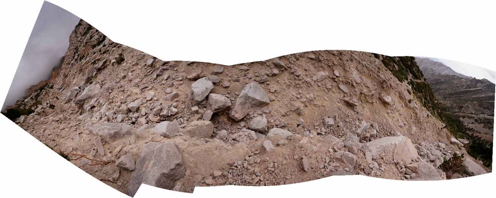 |
| Panorama of the trail washout |
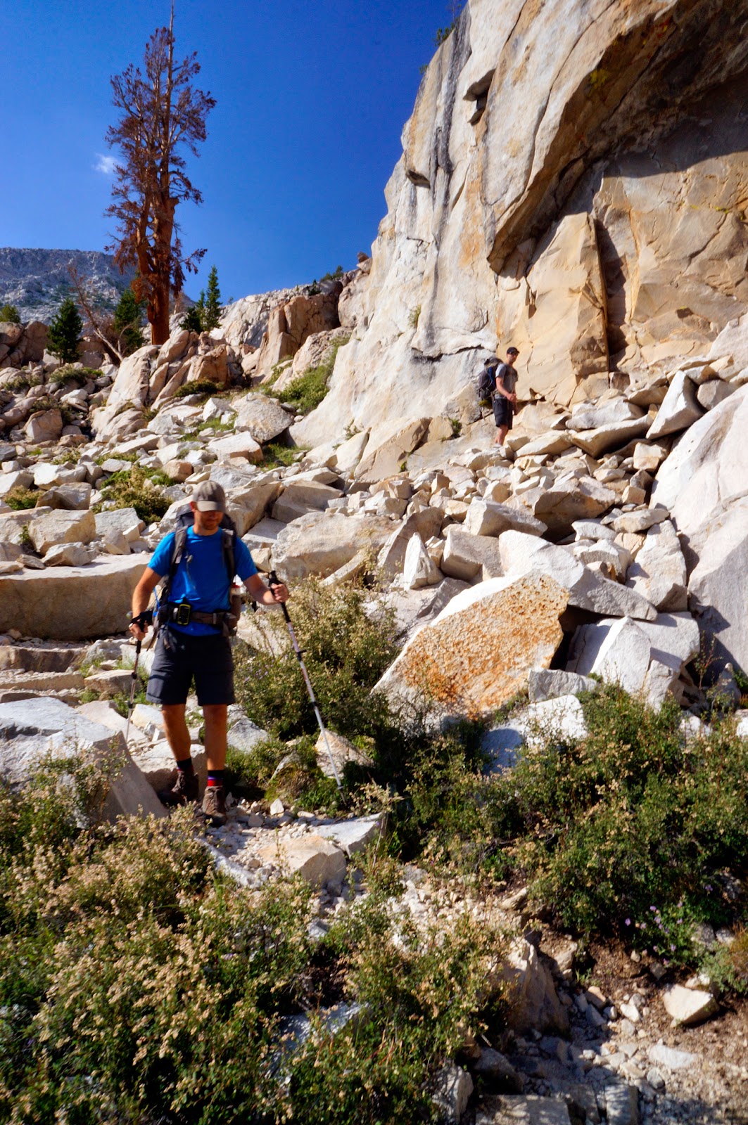
I passed three more guys on the way up who were again skeptical of my making it over the pass. "Let's see how far I make it." I said, on one hand not intending to kill myself physically on Day 1, but on the other not wanting to get behind schedule on my first day. The trail climbed and climbed to the site of the Washout, which was a deep gouge in the side of the hill, but after hunting around a bit I found a way through that some previous hikers had marked with cairns. And then the trail kept right up with its climbing and climbing and climbing. But I like climbing. It's my specialty. I am my mother's daughter and we were apparently bred to be pack animals. Besides, when you climb it means you are going up, and the views are always better from up. Before I knew it, I was halfway up the pass and enjoying it thoroughly despite the rain, the lack of a trail for much of the talus field part which had been wiped out in a rockslide, and not having adjusted to the altitude, which I was definitely feeling. I made it to the top, feeling sleepy but good, took a selfie, and enjoyed the gentle descent into the spectacular high alpine tundra-like meadows of Tyndall Creek.
 |
| Mt. Wiliamson |
 |
| The final switchback to the pass with Mt. Tyndall to the left |
 |
| Made it!! |
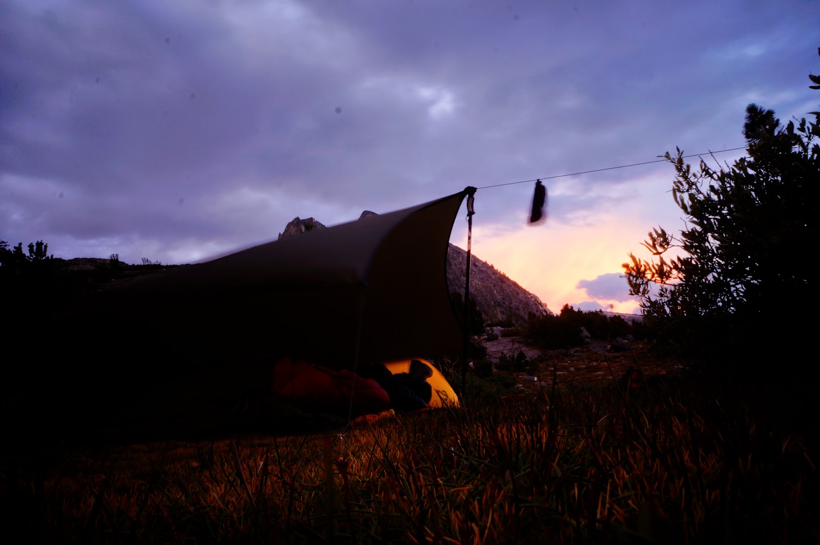
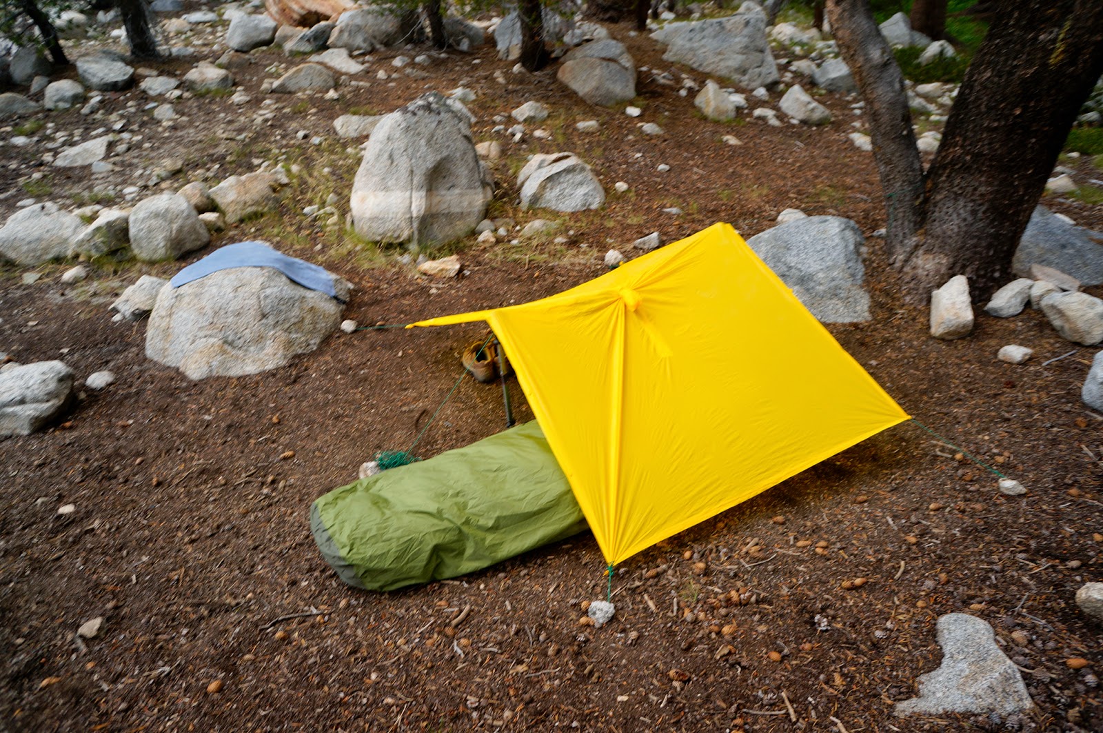
Or rather, I enjoyed the descent until my stomach decided it had had quite enough of hiking and demanded dinner NOW. So I found a spot to camp. And that's when the rain really got started. So there I was, my first day on the trail, freezing in my poncho (again, my rain gear was somewhat lacking due to this crazy idea I had that it hardly ever really rains in the Sierras in the summer...but at least it kept me dry), attempting to cook my meal. I managed, and stomach said it was delicious. And then came one of the low points of the trip when I had to clean out my DivaCup--did I mention that I was on the heaviest day of my period? I was, maybe I did so well that day because compared to cramps the pain of climbing 6000+ feet was trivial) while squatting inside my poncho with a bottle of soap and my water bladder. Then I had the challenge of setting up camp and keeping both my clothes and my pack, bivvy, and sleeping bag dry when my poncho was supposed to also be my rain tarp. It wasn't fun, and I spent a lot of time griping at my previous self for deciding on the bivvy over my one-man tent. Sure, it saves weight, but at least it's a dry place to sleep! I managed to rip the poncho, patch it with duct tape, rip it again, and patch it again, before I was finally, in a break in the rain, able to slither into my damp sleeping bag for the night.
But it was beautiful. The sunset was stunning. And although the whole rain thing was a bummer, I was really, really happy. I was alone in the mountains. I love being alone in the mountains. I laid in my bivvy and watched the sun set behind the High Sierra through the gap between the ground and my poncho-turned rain tarp. I had made it home.
 |
| Home sweet home |
 |
| Sunset over the Sierra |
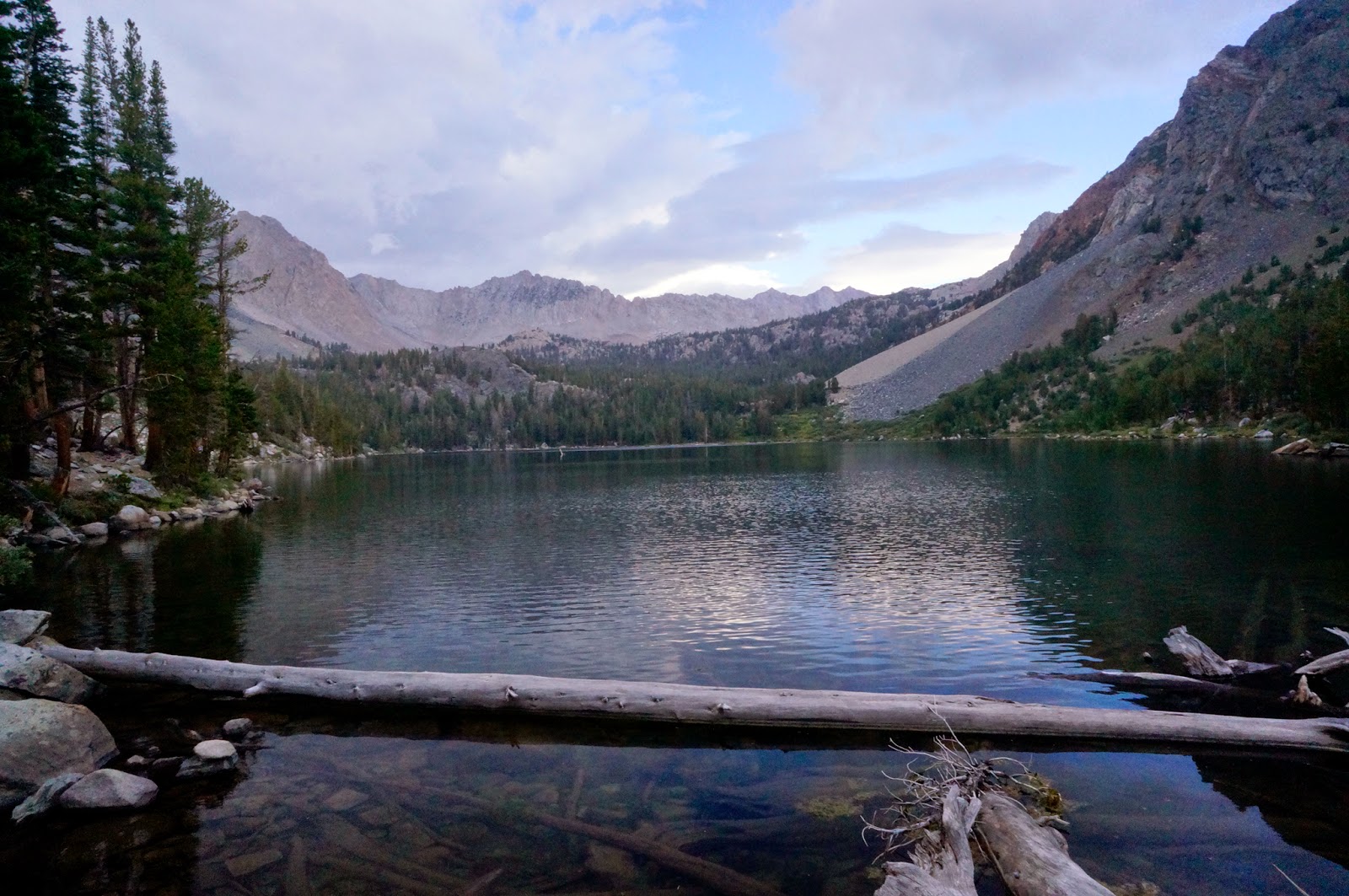
Day 2: Tyndall Creek to Bullfrog Lake over Forester Pass
14.6 miles
Start: Tyndall Creek (11600')
High Point: Forester Pass (13180')
End: near Bullfrog Lake (10600')
I woke up to the sound of a coyote yipping entirely too close to my bivvy at 5:20 am after a fitful night's sleep in sporadic rain and way more cold than I had expected for the time of year (and the damp bag didn't help the situation). I extricated myself from my bivvy bundle and peeked outside, and sure enough, there was a coyote running a nice circle around my camp. I sat up, and it glanced at me, but kept circling. I got out of the bag, stood up and told it to go away, but that had little effect. Finally, I lunged at it, and it loped off. I grew up in a place where we had bears and coyotes and cougars and I'm not afraid of them, but I sure didn't like having it circling me while alone in my bivvy a full day's hike from anyone. I knew I wasn't going to get back to sleep after that, even though I needed it, so I started to pack up camp. As soon as I did, the rain started up again, although gently. The morning chores were somewhat easier in the lighter rain (including another round of awkward DivaCup washing...so much better than hauling and packing out a bunch of disposable products, but still a giant pain in the vagina), but it was
cold, and my fingers were quickly frozen as I tried to filter water for the day. I know the water up there was probably totally safe, but didn't want to take any chances. I hoped the sun would come out later so that I could dry my stuff.
I got walking and the rain stopped, but the skies were dark and threatening, and I hiked with my poncho ready and my down jacket on which I would normally never do, even in winter while splitboarding, but it was that cold.
I cut across the tundra toward where I thought the JMT should be, taking bites out of the breakfast bars that I had made as I walked. Nature called, and I stopped to dig a hole and take care of business. It always amazes me how the volume of poop seems to double the volume of what I eat while backpacking. It used to be that I couldn't poop for days while backpacking, but this was already poop #3 for this hike. It worried me, because I clearly had not brought enough toilet paper to last me until my next resupply. I'd have to get creative, and be careful to stay sanitary. I had heard disturbing stories of "Monkey Butt" rashes and staph infections in distance hikers and didn't want that!
Steps later, I found the trail. I laughed when I realized how close, and in full view of the trial I had been. Thankfully there was nobody for miles. Getting to the famous John Muir Trail was a celebration. I was on my way!
 |
| The John Muir trail!! |
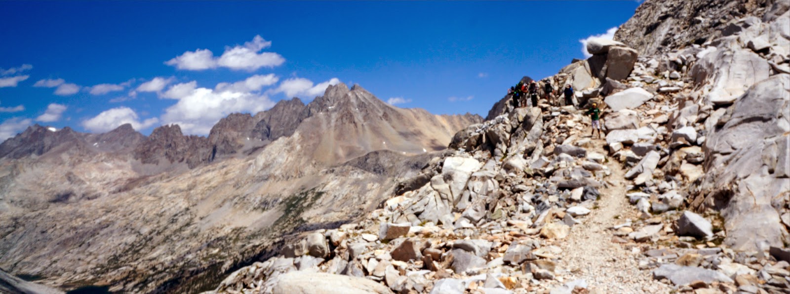
Progress was slow because of the altitude, but it was pretty. My goal for the day was to make it up and over Forester Pass--the highest-altitude pass on the entire Pacific Crest Trail--and to Vidette Meadow. The trail seemed to be heading straight at a cliff. It wasn't until I had reached the bottom of the cliff, heard voices, and spotted people coming down the pass that I finally saw where the trail went--it was cut into the cliff! Impressive. The group was an adorable family of five--the parents, two kids, a little boy, his early teenage sister, and the kids' friend. They had four more days to go before exiting at Whitney Portal. What an awesome adventure for kids! They seemed to be enjoying themselves.
 |
| The trail to Forester Pass |
The climb up the pass was slow and tough, but interesting with its crazy blasted rampway cutting up the cliff, and it warmed me up, which I was glad for. I finally changed out of my down jacket and into a long-sleeved T-shirt (with my hat and gloves still on). The views of the mountains were gorgeous, all the way to Mt. Whitney in the distance. I didn't see anyone until I got to the top of the pass, and then a crowd arrived on their way down. I saw 117 people on the trail that day (vs. 10 the day before). They were mostly groups and couples, with a few solo guys (all of whom were good-looking and nice, proving again that I need to find myself a mountain man) and two solo women (1 of whom was running??!). The trail eye candy (both of the man and mountain variety) totally made me hike faster. The marmots, chipmunks, and pikas (including a baby pika! aaaawwwwwww!!) slowed me down, though, because I always felt compelled to stop and chat with them.
 |
| View to the south from Forester Pass |
 |
| View to the north from Forester Pass |
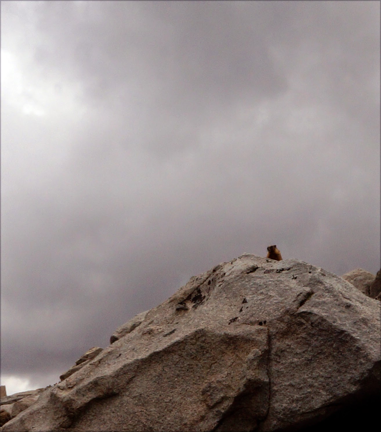 |
| Marmot! Heeey fattyfattyfatty |
 |
| Pika!! |
At one point I came up with the genius idea of passing a note to some southbound hikers to deliver to my family to (1) let them know I was still alive and well, and (2) ask my sister to bring me more toilet paper than I had packed in my resupply as well as a new poncho and extra SD card. I started asking the people I passed when they expected to exit, and handed my note with my dad's email address to the first couple I found who would be getting out in fewer than a lot of days.
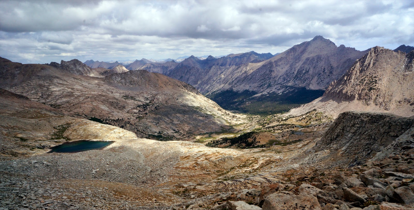
I stopped for an hour to rest my feet at a little lake at the bottom of the pass. The sun finally started to peek through the evil clouds. I watched the mountains, stared into the cobalt lake, and felt peace wash over me. The mountains are, and always have been, my church. It's where I find the sense of reassurance, calm, joy, and sense of my place in the universe that others call on God for. The mountains are where my soul's God lives, it's where my soul lives, and after years of neglecting it, I hope I've finally learned that I need to make regular pilgrimages to stay healthy, happy, and centered.
 |
| Lake below Forester Pass |
|
 |
| Beautiful tree |
|
 |
| Vidette |
|
I started back up just in front of two guys that I had seen from the pass approaching from Whitney. They were remarkable in that they were also hiking north; nearly all JMT hikers start in Yosemite and hike south because it's easier--you don't start out with brutal climbs at high altitude with no easy resupply options for 100 miles... I was faster on the downhill, but they passed me when I stopped at Vidette Meadows to filter water. I decided not to camp in Vidette as I had originally planned since it was only 2pm. So after a short break, I continued on to Bullfrog Lake. By then I was tired. Physically tired, but also lack-of-sleep exhausted. I stopped and made dinner, a massive 980 calorie bomb that the cute guy at REI had sold me on, warning me, "Only cook it when you really have an appetite. I'm a total glutton, and I have a
really hard time finishing it." I finished it no problem. I had the beginnings of a blister on my left heel and the bottoms of my feet ached terribly, and my knees were sore. But I ibuprofined up and called it good. I cleaned up (myself included) and just as I put my clothes back on the two Northbounders came walking by. Where did they come from??
 |
Evening camp activity 1: cook dinner
Evening camp activity 2: while dinner is cooking, dry socks |
 |
| Evening camp activity 3: charge the camera |
 |
| The most beautiful kitchen is the backcountry kitchen |
As it turned out, they were supposed to pick up a resupply from friends at Bullfrog Lake and had been waiting. The friends never showed up. They later found out that the friends actually had come, but then turned around and left with all their food when the guys didn't show up when expected. So they were out a few dinners and would need to make it all the way to Bishop Pass (where more of their friends and my sister were hiking in with resupplies) on what they still had with them. I felt terrible for them, and pondered their dilemma while packing up my stuff to find a place to camp. I wandered back down the hill a bit toward where I had seen a campsite earlier, but the guys were occupying it. Not wanting to be around humans, I skulked back up the hill and found a bit of level ground between some trees to call home for the night. As I laid down in the bivvy, I felt oddly reassured that the guys were nearby. Maybe they'll keep the bears and coyotes away, I thought.
 |
| Home sweet poncho tarp |
Day 3: Glen Pass & Rae Lakes
14.5 miles
Start: Near Bullfrog Lake (10600')
High Point: Glen Pass (11978')
End: Woods Creek (8800')
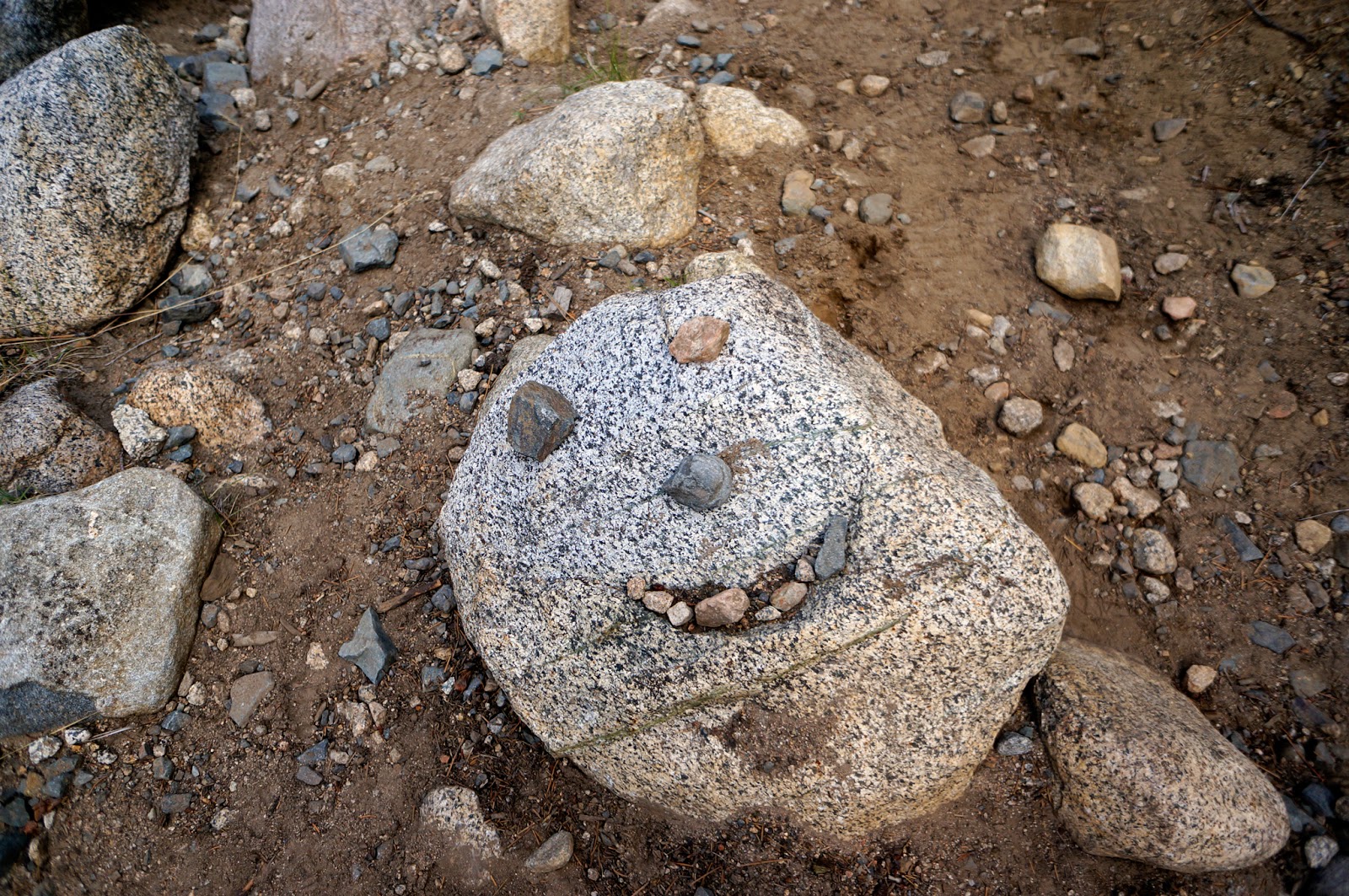
After another night in the rain, I was feeling woefully underprepared for dealing with non-typical Sierra summer conditions (The cardinal rule of the Sierras is that it Never Rains At Night, and never rains for more than a few hours. Ha! Not this summer.). I woke up early-ish, but was late getting out of camp because I spent an hour avoiding dealing wit the blister on my heel. When there were no more activities I could do to procrastinate the unpleasant, I popped it, put on antibiotic ointment, a bandaid, and sealed it with duct tape. I cleaned the DivaCup, pooped (what a great morning!), and left camp before the guys stirred from their tent as I walked by their camp down the hill. I had cool, cloudy weather for the climb up Glen Pass, which felt harder than it should have. I prefer tight switchbacks to interminable roundabout gentle climbing. I like to see where I'm going, where the goal is, like to just power up and get it over with.
 |
Proper pooping procedure.
I will spare you photos of the middle step. |
 |
| Switchbacks through trees. Not my favorite thing. |
 |
But at least there were sweet wildflowers,
Indian Paintbrush was my childhood favorite |
But the views were stunning as usual. I was starting to fall subject to the curse of the Trail: you get used to being stunned every time you turn a corner.
 |
Views like this: worth it
View from Glenn Pass |
 |
Views like this: I'll put up with a lot of pain for this.
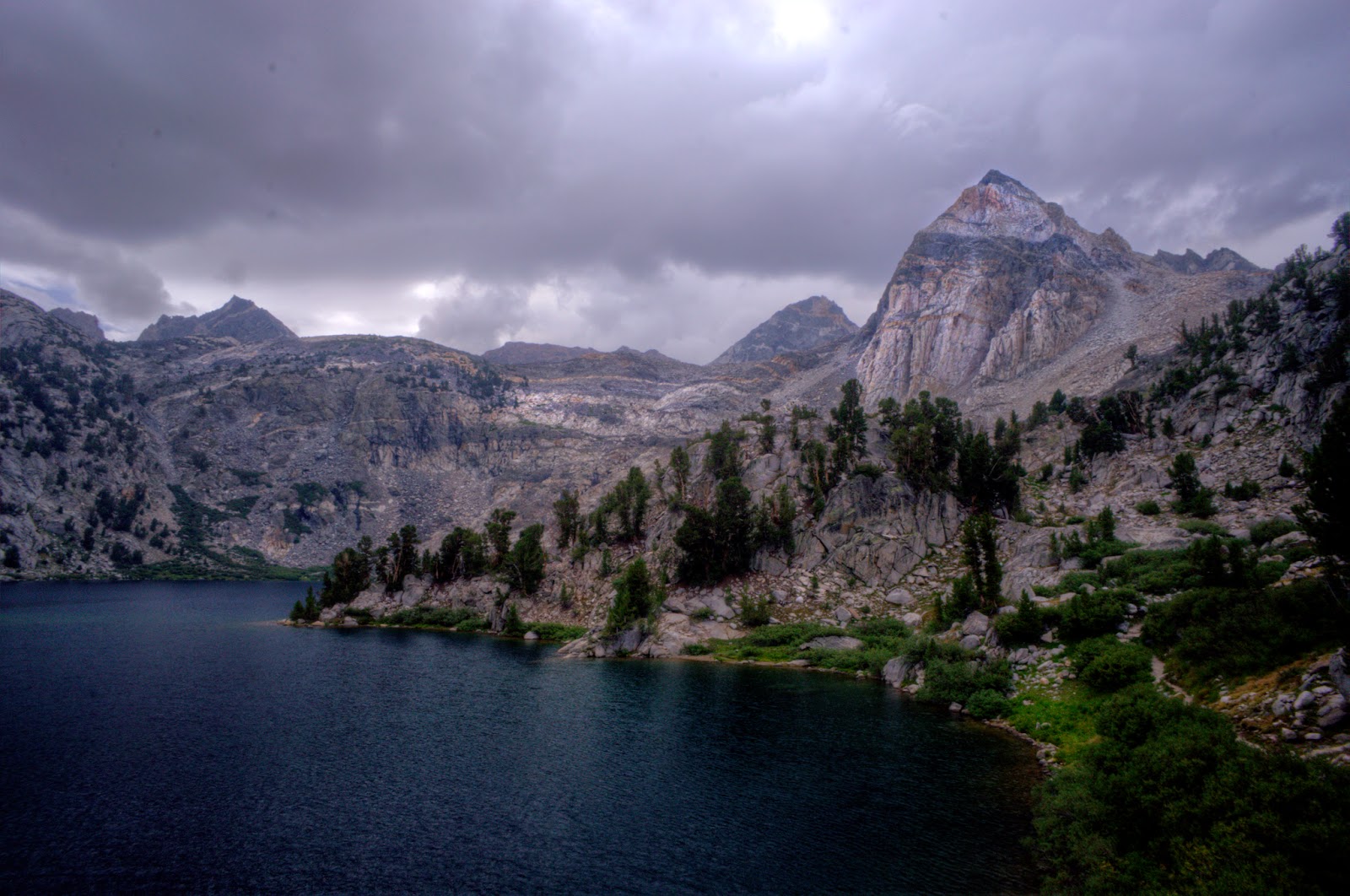
Ray Lakes with Painted Lady in the background right |
I descended the other side of the pass into the Ray Lakes basin and was excited about stopping to go fishing for lunch. In my excitement, I managed to take a photo of the sign pointing me down the trail at an intersection, and then proceeded to walk down the wrong trail. I realized my mistake after about half a mile and a few hundred feet of climbing...wait, I wasn't supposed to be going
up... I made it back to the lakes just in time for the rain to start up again. Hard this time, a veritable deluge that came on so suddenly that I didn't get a chance to throw my poncho on before getting soaked. I walked quickly around the lake, trying to find a place where I could stop and hide from the rain until it passed. I found a tight grove of trees that was staying fairly dry, and set up my poncho as a tarp there and sat for a while.
 |
Okay, Carie, you have two choices:
Left has you retracing your steps, all the way to Mexico if you want.
Right goes where you want to go, and continues all the way to Canada.
I went straight ahead.
Why? Because I'm a spaz. |
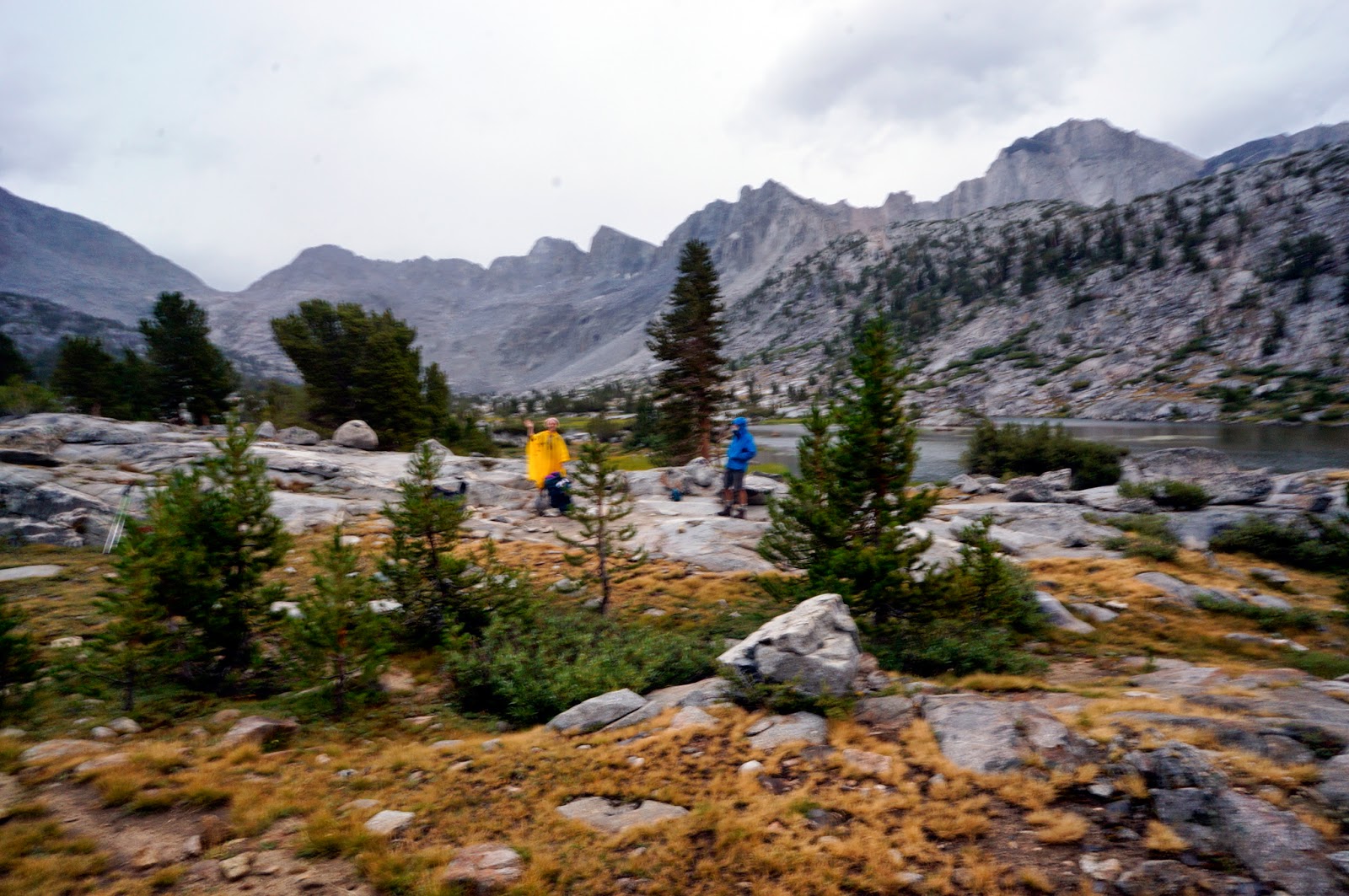
The rain showed no sign of letting up, so I called it lunch and naptime and settled into my sleeping bag and fell asleep. Two hours when I woke back up, it was still raining hard. I was worried about staying dry, the bottom half of my bivvy was soaked, my sleeping bag starting to get even more damp than it was before (I had planned on drying the bag while fishing at lunch...oops), and if I got back on the trail all I had was my poncho to keep myself and everything dry, kind of hopeless since in that sort of rain, water leaked in through the sides of the poncho, and my bottom half and most of my pack weren't covered and would quickly get drenched (although I did have garbage bags inside the pack where I kept my change of dry clothes and sleeping bag). I was kicking myself for not bringing rain gear--at least a pack cover, rain pants, and a waterproof shell. But I had not expected this kind of weather. The forecast right before I left was for the standard scattered thunderstorms for two days and then sun. This was a different beast. I hoped it would clear up in the evening or the next day, better yet immediately since I still had 7 miles to go to stay on track. I was getting stressed thinking that it would have been a good day to put in some extra distance to make sure I would make it in time to meet my sister with the resupply she was bringing in. I decided to rest some more, read a book, and try to make up for lost time when the weather cleared.
 |
| Wet Carie is Sad |
 |
| Clearly, this situation calls for a nap |
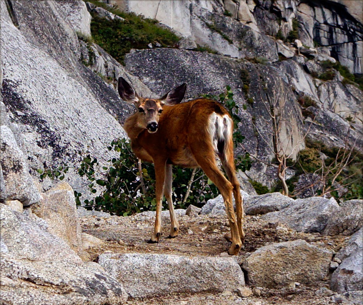
Another hour later, and the rain wasn't any better. I decided to get up and go for it. I'm completely hopeless at packing in the rain, and it took me an hour to get all of my stuff back together. Everything was wet. I threw on my pack and set out with my ridiculous poncho tied with paracord around my backpack and myself to try to minimize the leakage. About fourty minutes later, the sun showed itself, but it didn't stop raining, the classic Pacific Northwest Liquid Sunshine. "Thanks a lot, asshole sun!" I yelled at the sky. An hour later, the rain stopped and the sky cleared and I quickly pulled out all of my stuff and yardsaled all of my stuff to dry on various boulders. I sat there for half an hour willing my stuff to dry out, and eventually my impatience got the best of me since it was already 5:30 and I had a long way to go, and packed up and continued on. Just as I did, a group of four mule deer bolted across the trail and up the mountainside. Magic.
 |
Fin Dome, which I couldn't see when I was walking
right by it because it was raining so hard.
You'd never guess from my photos of that day. |
 |
| See! That's a river, not a trail. Sheesh. |
 |
Yardsale!
Taking advantage of the break in the rain to dry all my stuff |
 |
| But... the views. |
I ran into the Northbounders doing the same thing farther down the trail. They must have passed me while I was napping. I finally learned their names when I stopped to chat, Xavier and Ryan, from the Bay Area. I remembered their food plight and gave them my pound of salami that I had been carrying around since I was now 3 days in and had barely touched my snacks, and definitely wasn't wanting sausage (probably because the altitude was making me somewhat nauseated). They were happy to take it off my hands. I told them I might have more food to share if we saw more of each other, and kept hiking, promising them at their request that if I found a good campsite, to flag them down.
I made it to my goal--the Road's End trail junction with its impressive suspension bridge over Woods Creek. The campground there was full of a few groups of wet people trying to dry their stuff and looked like a gypsy camp. I had also heard that the place was full of "bears in trees, lots of bears in the trees". I didn't want to stay. I still had about an hour before dusk set in, had had a long nap, and the low elevation and new friends had given me a burst of energy, so I decided to hike a bit farther to get more peace and quiet. I crossed the suspension bridge and started to climb.
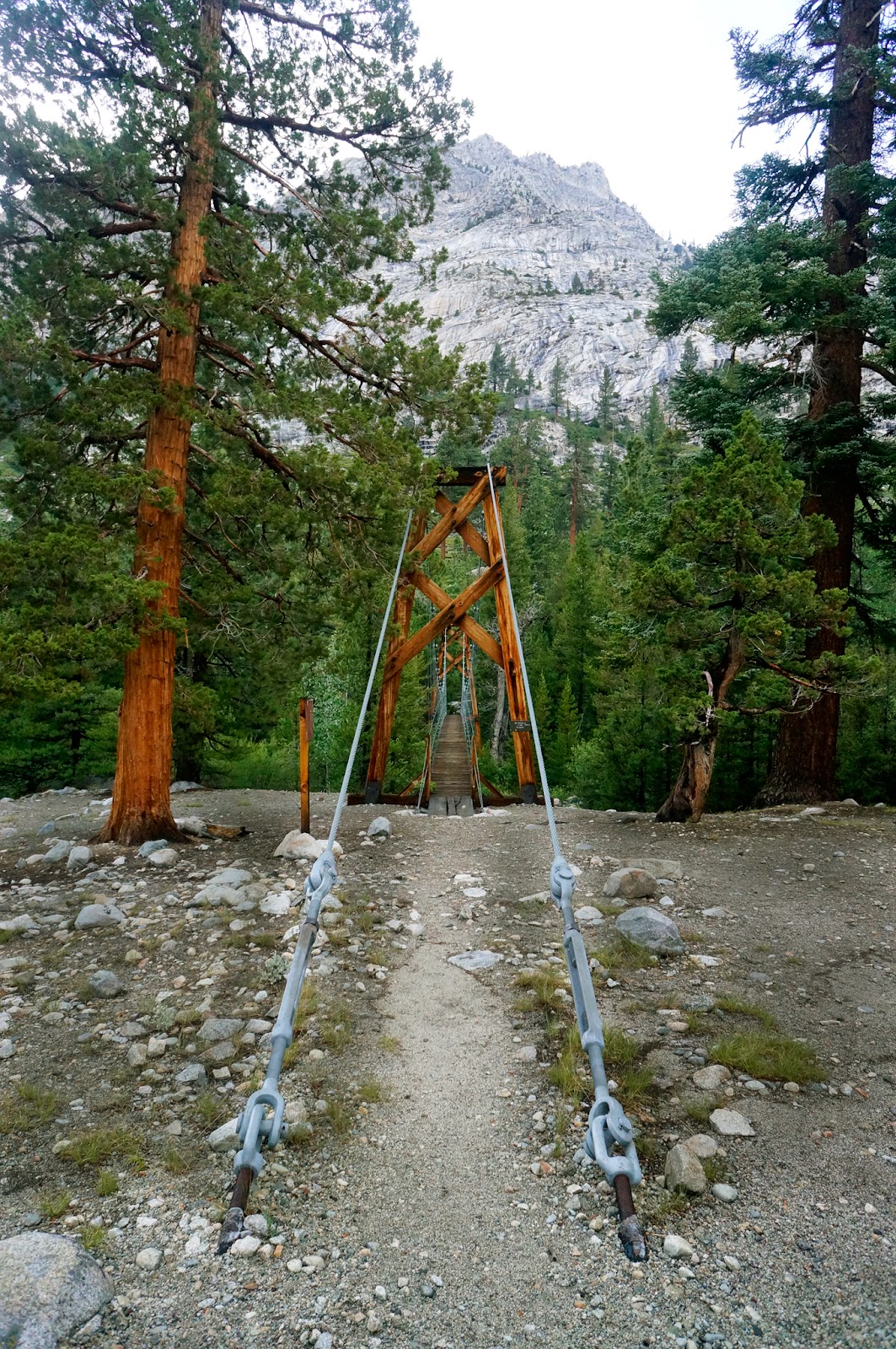 |
| The suspension bridge over Woods Creek |
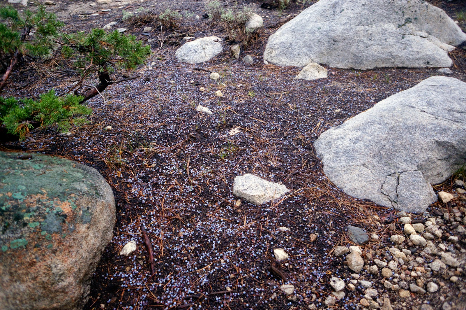 |
Juniper berries littering the ground.
If I boil these in my camping cup, will it make all of my food taste like gin?
Please? |
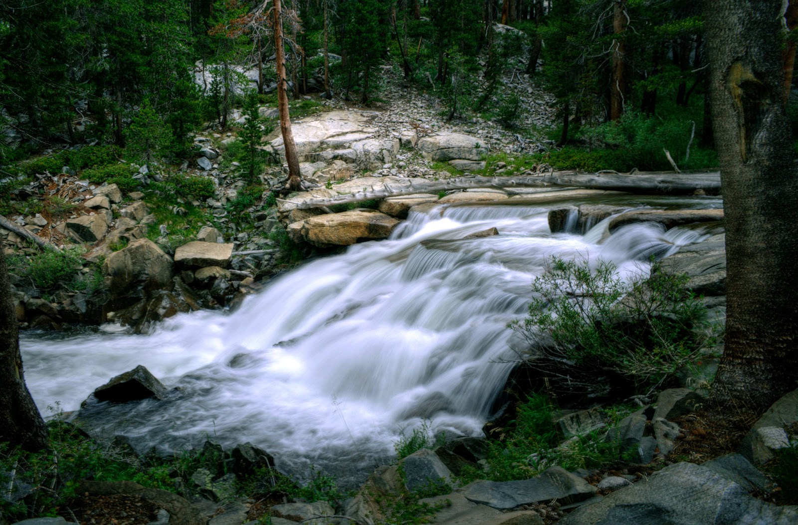
The lush, damp forest was a marvel. It's amazing how in one day the trail went from stark, barren granite faces at Glenn Pass to sparkling alpine lakes at Ray Lakes to this rainforest at the bottom of the basin.A little under a mile up, the trail bent around a beautiful granite ledge overlooking a waterfall and the mountains and was greeted by a Southbound hiker named Allen who said he hadn't seen any good spots for several miles and welcomed me to camp there with him. I accepted, charmed by the view.
 |
| View at the campsite |
 |
| The campsite |
I went to the stream to wash up and filter water, set up my poncho tarp, and just as I was sitting down to dinner Xavier and Ryan showed up and set up their camp. They have a nose for food, those guys. I ate my awesome freeze dried dinner (everything tastes awesome after a long day of backpacking) on a boulder while watching the setting sun turn the sky pink.
Day 4: Pinchot Pass & Lake Marjorie
13.8 miles
Start: Woods Creek (8800')
High Point: Pinchot Pass (12130')
End: Kings River South Fork (10260')
I got an early start, left the guys behind, and made it up Pinchot Pass by noon. I stopped at the top of the pass and had some snacks, and the local ground squirrel was so charming, so adorably fat, so friendly, and so insistent that I did what I never ever do and fed him a nut. The manipulative little twerp. The hike up was really pretty and I had several Aaaaaaaaaaaaaa!! moments with the good weather, open vistas, and bright blue birds chasing each other through the landscape. I also saw my first horses on the trail, which was a sort of bizarre moment of thinking, "Really? You take horses over these passes?" I was charmed, until a few feet down the trail when I had to wade through fresh horse poop. This would become an increasingly common occurrence the farther I went north.
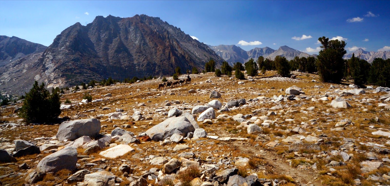 |
| Horse team delivering supplies to... ??? |
 |
| Holy crap, it's not granite! |
On my way down the other side of the pass, I crossed a woman hiking south who, from a distance, looked stunningly purple. As I drew closer, I noticed her white hair and enormous pack. She was 88. Soloing the John Muir Trail, charging up the challenging pass like a champ. And wearing a purple dress. She may as well have been wearing a superhero costume, because she is mine!
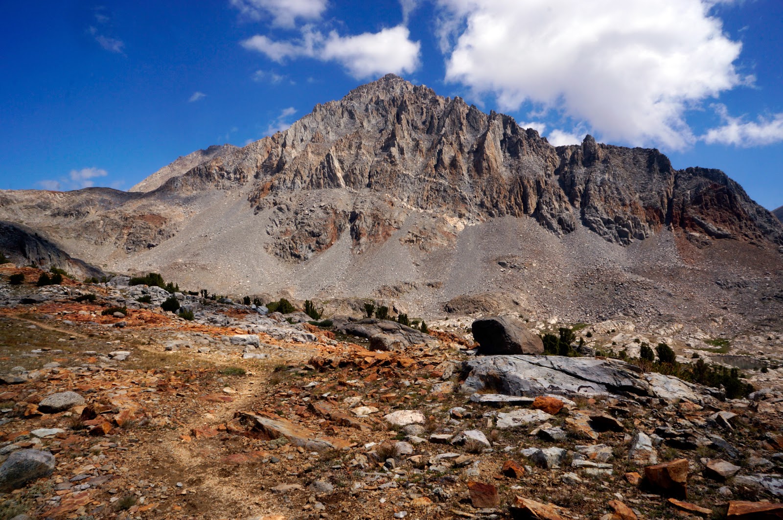 |
| Trail toward Mather Pass |
 |
| Me, blocking another ridiculously stunning view from the top of Mather Pass |
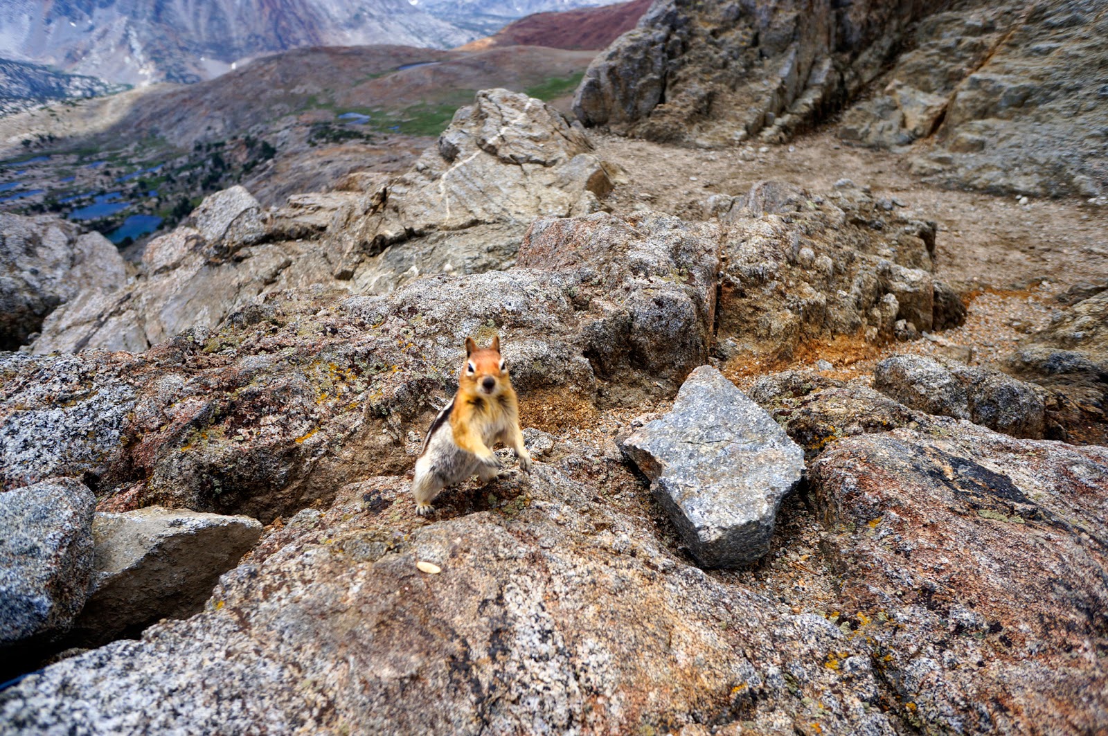 |
Every pass had its guardian ground squirrel or marmot.
This was Henry. He likes cashews and raisins.
And everything else. |
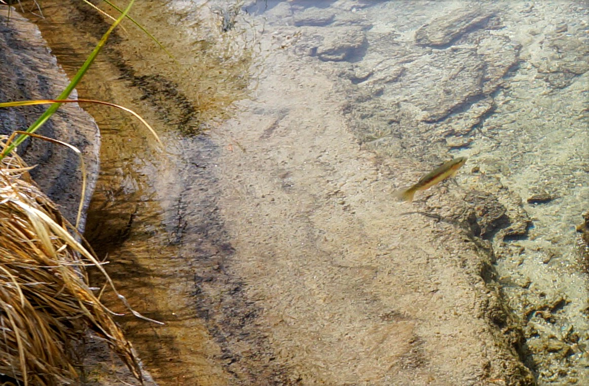
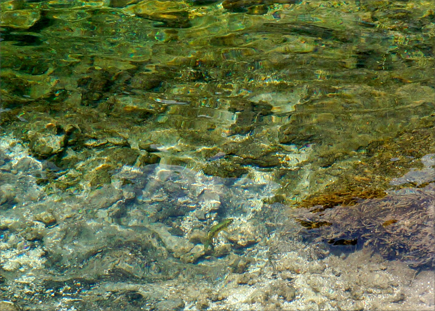
Marjorie Lake was my original goal for that day and I was there before lunch. I went for a dunk and tried to scrub some of the filth off of my sweaty self, and dried out along with my damp stuff in the intermittent sun. I did laundry in the bear can, hung my clothes up to dry, had lunch, then finally, finally, was able to pack my fishing rod out and attempt to fish.
I was glad nobody was watching because first I threaded the reel wrong and it took me a good 10 minutes to figure out why it wasn't working. I finally got it together, and viola! I shit you not, I caught a fish on the first cast. Now what? He was sort of a little guy, but I couldn't believe my luck and decided he would be lunch.
 |
| Caught one! |
 |
| Slayer's very ill-fated first victim, temporarily holding still |
The one part of the fishing process I hadn't been taught was how to kill the fish. "Bash it over the back of the head with a rock" was what had been suggested, and I was prepared and had a rock as well as my leatherman and cooking supplies out and ready. I bashed. The fish flopped violently. I bashed again, the fish kept flopping, gills flapping, I kept bashing and bashing and bashing, but the poor fish wouldn't die! It was awful. In a desperate attempt to kill it and put it out of its own desperate struggle, I picked up the line, swung the fish over my head, and smashed it against the rock, hoping that would snap its neck or something. Instead, the line snapped, sending the fish flying back into the water, out of reach, to die a horrible maimed death.
I don't know what it says about me that, although horrified, after tearing up and calling out, "I'm so sorry fish, I'm sorry!", I picked the rod back up, strung another fly, and tried again. The next one was bigger, and this time I was armed with a bigger rock. The bigger rock did the trick. Dead fish. I'd be eating lunch. I tried for more and caught three more really small ones that I let go, although that was also traumatic since I'd never done that before either, and in my attempts to unhook the first fish, its whole jaw ripped out and the fish fell into the water and darted away. I sat there staring at the fish jawbone dangling from the fly hook on my line, disgusted, mostly with myself, and again apologized profusely to the poor, now jawless fish. But I tried again. Caught again. Let two more go (with more finesse this time) before deciding that I hated catch and release and I'd be eating whatever I caught from then on out.
 |
| Picture of a flower, since the previous text was disturbing |
I gutted the one fish I had kept, spiced it up, put it in the aluminum foil I'd specifically brought with me for this purpose, lit my stove, and put the aluminum plate that I thought I had been very clever in purchasing as a cheap, lightweight skillet. The aluminum plate started to hiss, and suddenly the center dropped out and the plate started to melt onto my gas stove. Probably would have been wise to test the setup out before going packpacking with it, right? I snatched up the plate, smelling the burning as my fingers scorched on the hot metal (smart again), dropped it and the aluminum-encased fish on the boulder where I'd been standing, and put out the burner. Now what? I thought maybe I could put the foil packet on the stove, but that burned (should have been a given--if the plate melted, the foil wouldn't do any better). Determined to eat this fish that I had just beat to death with a rock, I considered just eating it raw. Nope, I can stuff this thing into my cooking cup, I thought. So I boiled water and stuffed the fish in it and poached it. It was a mess. But the fish cooked, and I ate it, and it was pretty tasty.
My evening tea tasted like fish for the rest of the trip.
 |
| Another flower! Please don't have fish nightmares. |
While all this was going down, a group of guys showed up, sat down for lunch nearby, and watched the spectacle. Once the imminent danger of destroying my stove with molten aluminum was over, I said hi and they came down to give Crazy Girl a more careful look-over. We chatted, they saw the fishing gear and got excited since they were fishermen and asked about the fishing, and I told them my story which had them in stitches, and at one point one of the guys teased me when I mentioned how horrible the killing part was by saying, "Whatever, Slayer." The nickname stuck.
I relinquished my beautiful lakeside spot to them and started to pack up, just in time because about four seconds after I hoisted the pack, it started to rain again. The guys helped me tie the poncho on securely, and I continued on my northward journey.
 |
It was like this, only coming from the sky.
One of the Kings River South Fork creek crossings. |
The sun soon returned, and it was a poster beautiful day in the Sierra. I was feeling no pain (after all, I had taken on the new persona of Slayer), or at least successfully ignoring it. The altitude had stopped bothering me and I was breathing freely. I made it quite a few miles in this slaughter-induced euphoria, several beyond where I had originally planned to stop that night, before my knees started to ache and I decided to call it good for the day. I set up camp in a nice spot next to the Kings River South Fork, successfully fended off the curious advances of several Southbound groups (it was a nice campsite, but Mountain Carie is an antisocial creature), and about an hour later Xavier and Ryan showed up.
 |
| Spotty clouds casting spotty light over the Sierra |
We chatted over dinner and it was then that Ryan informed me that they were Mormon after they told me where they went to college and the answer for one of them was BYU. At first I thought he was joking, pulling the whole, "Yeah, I'm from Utah, I know you're going to think I'm Mormon now, haha," thing and then pull a flask of home-distilled whiskey out of his coat pocket, but he was serious. Then with a straight face, Ryan asked me, "Have you ever met a Mormon before?" in a way that sounded like a lead-in to the myth-dispelling missionary spiel with a twinge of worry that, given this new information, I'd slip out of camp in the night to avoid a morning baptism or mandatory jell-o breakfast. I laughed, and told him that half of my family and several of the good friends I grew up with are Mormon, that I actually went to services for a while in high school, and that I was very familiar with the church and his kind. Like, "dude, you're fine, we can still be friends, I'll just tone down my language and not expect you to join me for beer after we get off the trail." So then we chatted about their mission experiences, their being (of course) Scouts now working (of course) in the financial industry in (what? there are Mormons there?) the Bay Area.
By dusk, we were all sound asleep in our respective mobile dwellings. It was a relief to have people I felt comfortable with in the camp with me, and I slept well.
 |
| Goodnight, world. |
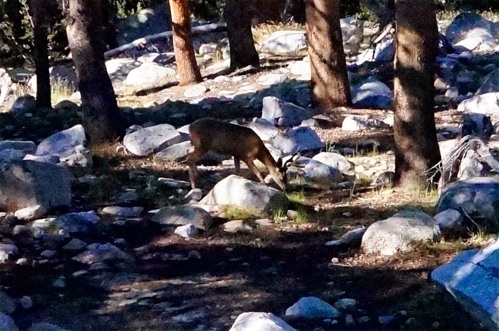 |
| Stag that visited us at the campsite early the next morning |
Day 5: Mather Pass & Palisade Lakes
~12 miles
Start: Kings River South Fork (10260')
High Point: Mather Pass (12100')
End Point: Deer Meadow (8800')
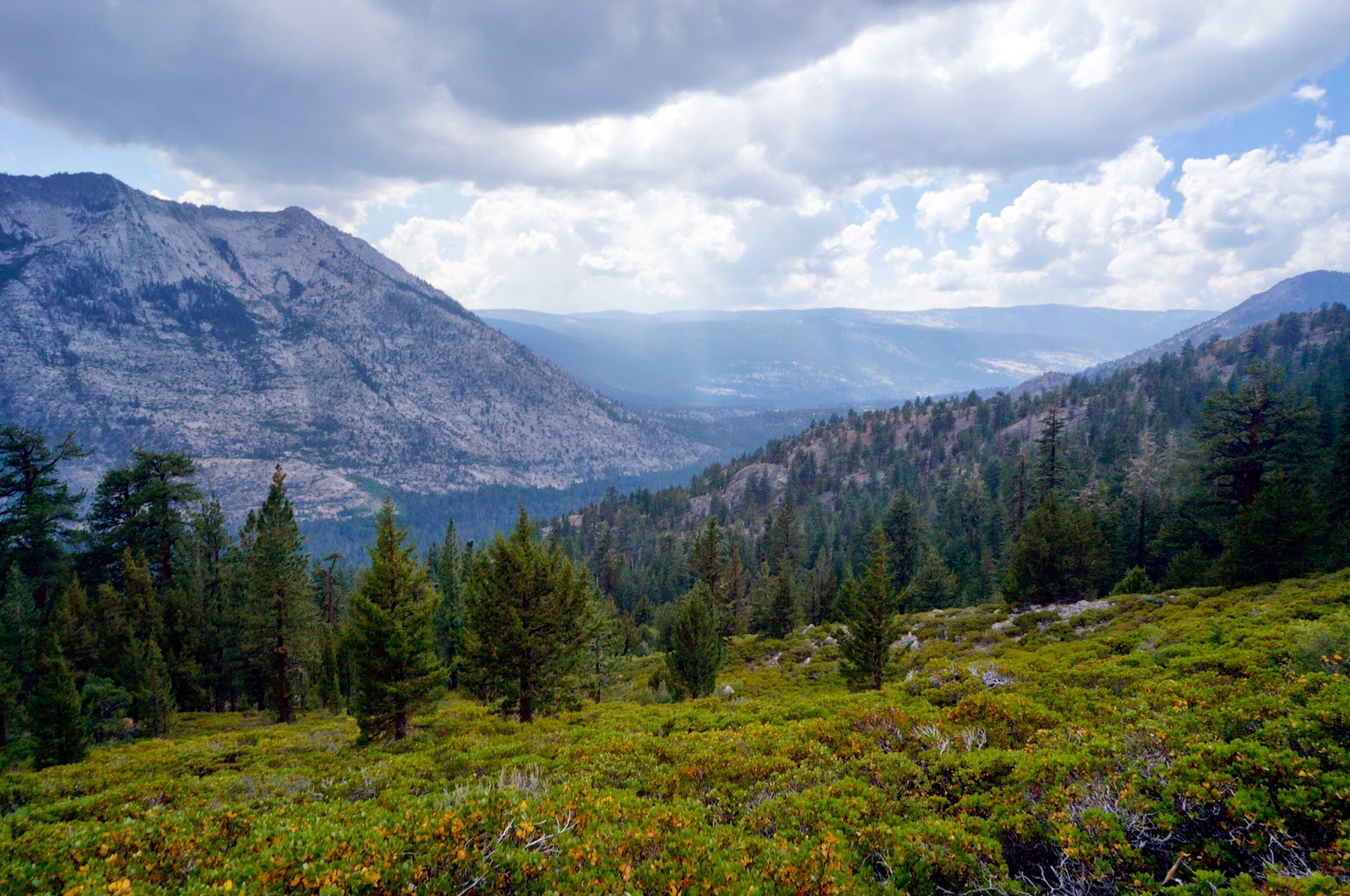
Lulled into complacency by the presence of new hiking companions, I slept in a bit and didn't wake up until the guys got up and started making their breakfast. I still broke camp before them, and climbed a long mellow uphill until the trail broke out of the trees at Upper Basin, a beautiful, rocky, tundra-like open landscape with dramatic mountains around it.
 |
Ugh, so sick of these views, can I please just go watch TV?
Upper Basin |
Like Forester Pass, it was hard to tell where the trail was going to climb up Mather Pass until I was on the switchbacks up, another trail built into the side of a cliff. For the first time, I made it up the whole pass without having to stop and catch my breath, just even steady walking the whole way up. I had finally acclimated to the elevation.
 |
| Wait, the trail goes where? Group coming down Mather Pass |
 |
Sorry, am I blocking the view?
Looking North from Mather Pass |
I stopped at the top and had a snack and chatted with a group of Southbound guys, but I was past due for my morning date with a hole in the ground and scurried off in search of a boulder to hide behind, not easy since the trail went down a steep slope above a boulderfield, and then wound around so that people had views of pretty much every boulder and down from the top from the trail, and there was a lot of traffic, as well as a trail maintenance crew on the trail. so much that all sides of boulders were at some point visible from some part of the trail. I found a circle of boulders, one of which overhung enough that I could sort of hide under it while doing my business. Fun times. It was a scenic toilet, with wild columbine in the shaded areas at the sides of the boulders and stunning views of mountains all around.
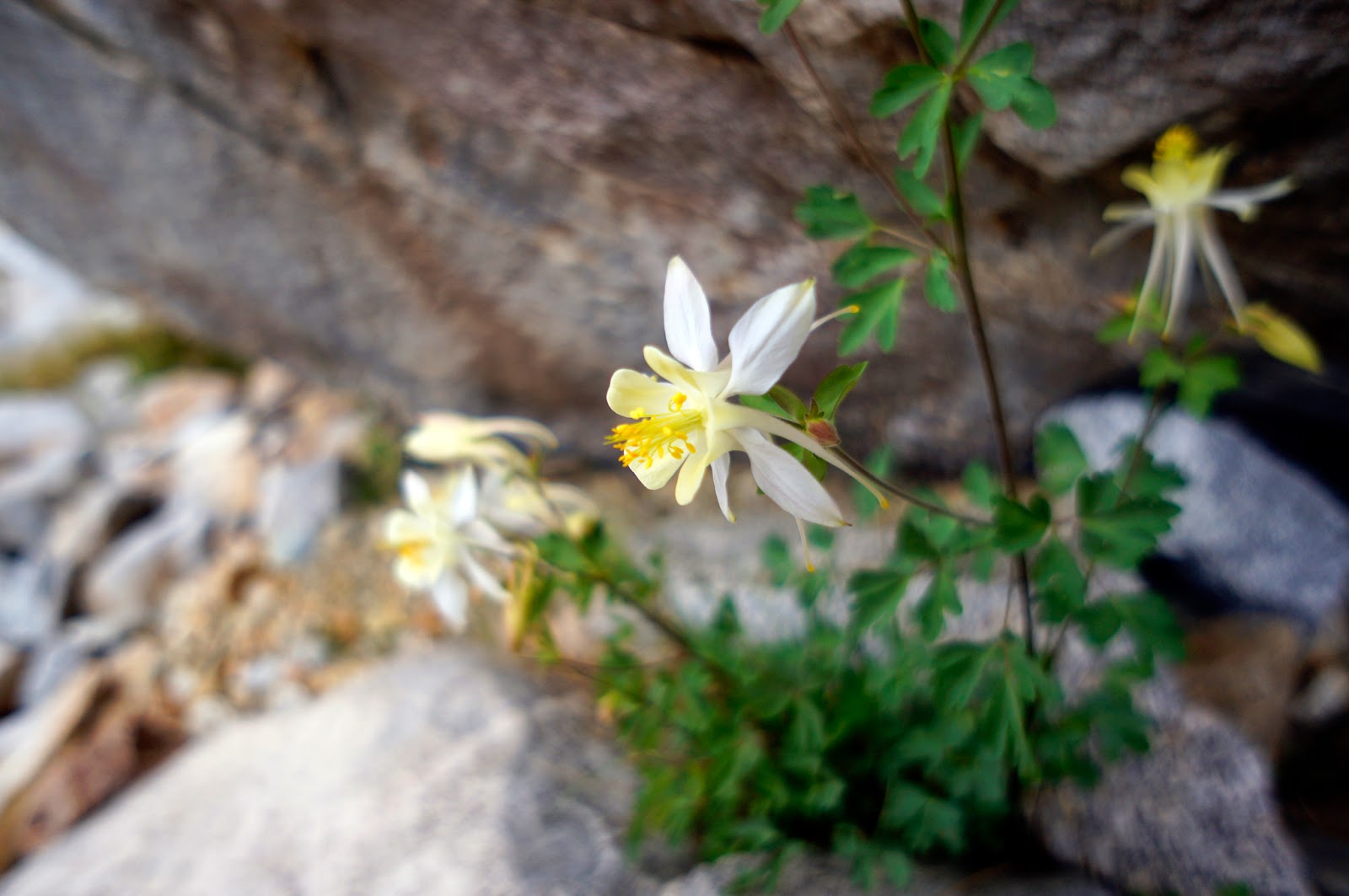 |
| Columbine |
 |
| More mountains |
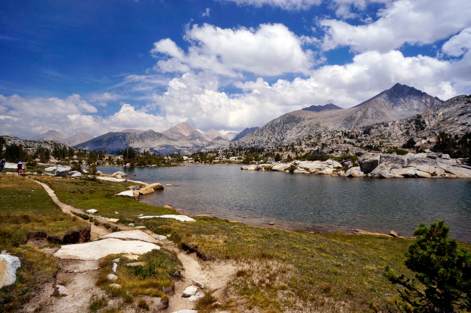
I made it down to Palisade Lake in time for a late lunch, and by the time I finished eating, the boys caught up to me. I tried fishing, but failed, a few strikes but no bites. I grossed them out with my stories about trying to kill the fish the day before. That's when one of them told me that the way to kill a fish is to cut off the head. I vowed to try that with the next one. The water was warmer than expected, and we all went for swims, grateful for some time without rain, although the sun was only intermittent. Once the clouds got thick enough to make lounging around at the lake no longer fun, we packed up and headed out.
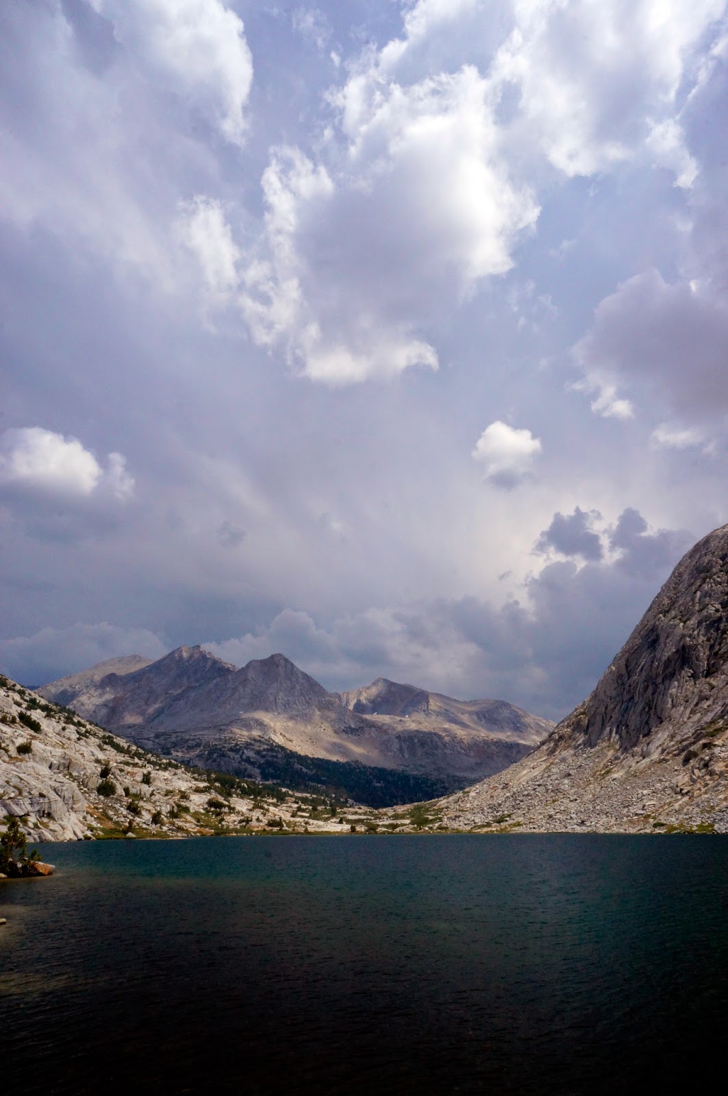 |
| Palisade Lake |
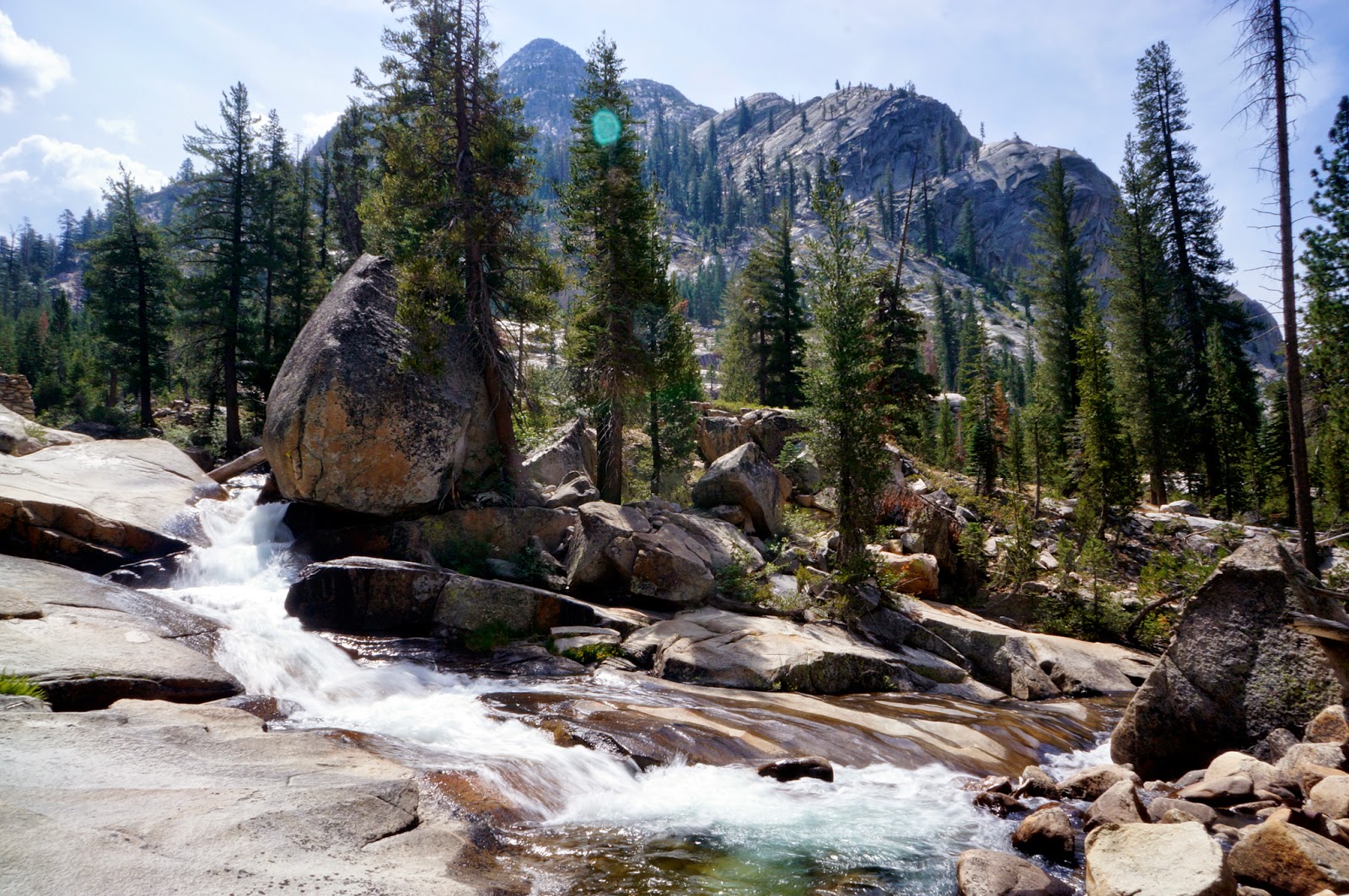
We soon came upon the famous Golden Staircase section of the trail, reviled by Southbound hikers as a hot, miserable climb. We got to go down it. There were waterfalls and lush wildflowers, and it was beautiful, it kept making me think of the Hanging Gardens of Babylon, which I was semi-obsessed with as a kid and once made an elaborate architectural model with real plants of for a class project. Some little girls want castles. I wanted a giant-ass palace dripping with lush plants and waterfalls. And I found it on the John Muir Trail.
 |
| Enjoying the views from the top of the Golden Staircase |
 |
| Waterfall draining Palisade Lake |
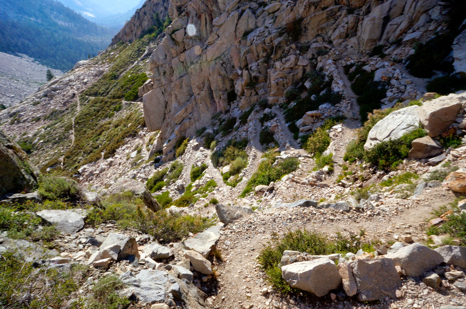 |
| Switchbacks of the Golden Staircase |
 |
| The guys coming down the Golden Staircase |
The Golden Staircase dropped us down into a forest, by which point we were all feeling our knees and ready to call it quits for the day. We found a nice spot in Deer Meadow (we did see several deer in Deer Meadow), which was all of our first time camping at a low enough elevation (below 10,000 ft) that we could have a campfire. Sweeet! You can bet we took full advantage of that.
We had an Indian feast out of several dehydrated Indian meals I was packing while the campfire effectively scared off the mosquitoes that were pretty bad in the area. Or maybe it was all the DEET. I sprayed myself down a little too close to where I had set up my poncho as a tarp, and it melted holes in it. Out came the duct tape to patch up my swiss cheesed poncho. Awesome.
 |
| Waterfall on Palisade Creek |
Day 6: Le Conte Canyon to Dusy Basin
~11.5 miles
Start: Deer Meadow (8800')
High Point: Dusy Basin (10800')
End: Dusy Basin (10800')
Finally! The day had come to meet my sister! I'd have food, chapstick, clean clothes to wear, and hopefully a non-holey poncho! I had been looking forward to seeing my sister the whole time on the trail. She was hiking in over Bishop Pass and the plan was to meet at the junction of the Bishop Pass trail with the JMT, although I told her that if I got there first and was feeling up to it, I'd hike up the trail until I met with her. So we had promised to leave obvious signs if we ever, even for a minute, left the trail.
I was torn between getting to the junction as early as possible so that I'd have lots of time to hike up to met her, and not wanting to stress my already stressed system. Jeannie had said that she was excited to see the JMT and there was no way I'd make it all the way over the pass like I'd originally thought might be possible, so it seemed to make the most sense to just meet her at the junction and camp. So, excited as I was, I slept in again, finally able to sleep after quite a few days of altitude and excitement and not-being-used-to-the-bivvy-sack-related anxiousness. I stopped at Grouse Meadow, which a hiker with a fly rod I had come across a few days prior had said I shouldn't miss. Sure enough, the fish were jumping. Whenever I see or even think about a fish jumping, I immediately get "Summertime" (Ella Fitzgerald, not Sublime) stuck in my head:
Summertiiiime and the livin' is eeeeeeeeeasyyyyy
Fish are jumpinnnnnn' aaaaand the cotton is hiiiiiigh...
 |
| Grouse Meadow |
 |
| Fish! |
I watched the fish, mesmerized, for a good while before pulling out my fishing rod. "Maybe they are bigger than they look from here," I thought, delusionally. The guys caught up with me just as I got started. They weren't as bitey as the ones at Lake Marjorie, but I mustered what little patience I have and, with some casting tips from Ryan, within half an hour I had caught four, three of which we deemed large enough to snack on. The beheading trick worked great for killing them quickly, and Slayer was disturbingly fine with it. Although I am amazed I didn't see bears at all during the first half of my trek, since my hands reeked of fish for days, despite washing with biodegradable soap, every time I gutted one. The fact that the guys, the boy scouts, wouldn't watch me kill or gut them cracked me up, so I put them in charge of cooking them.
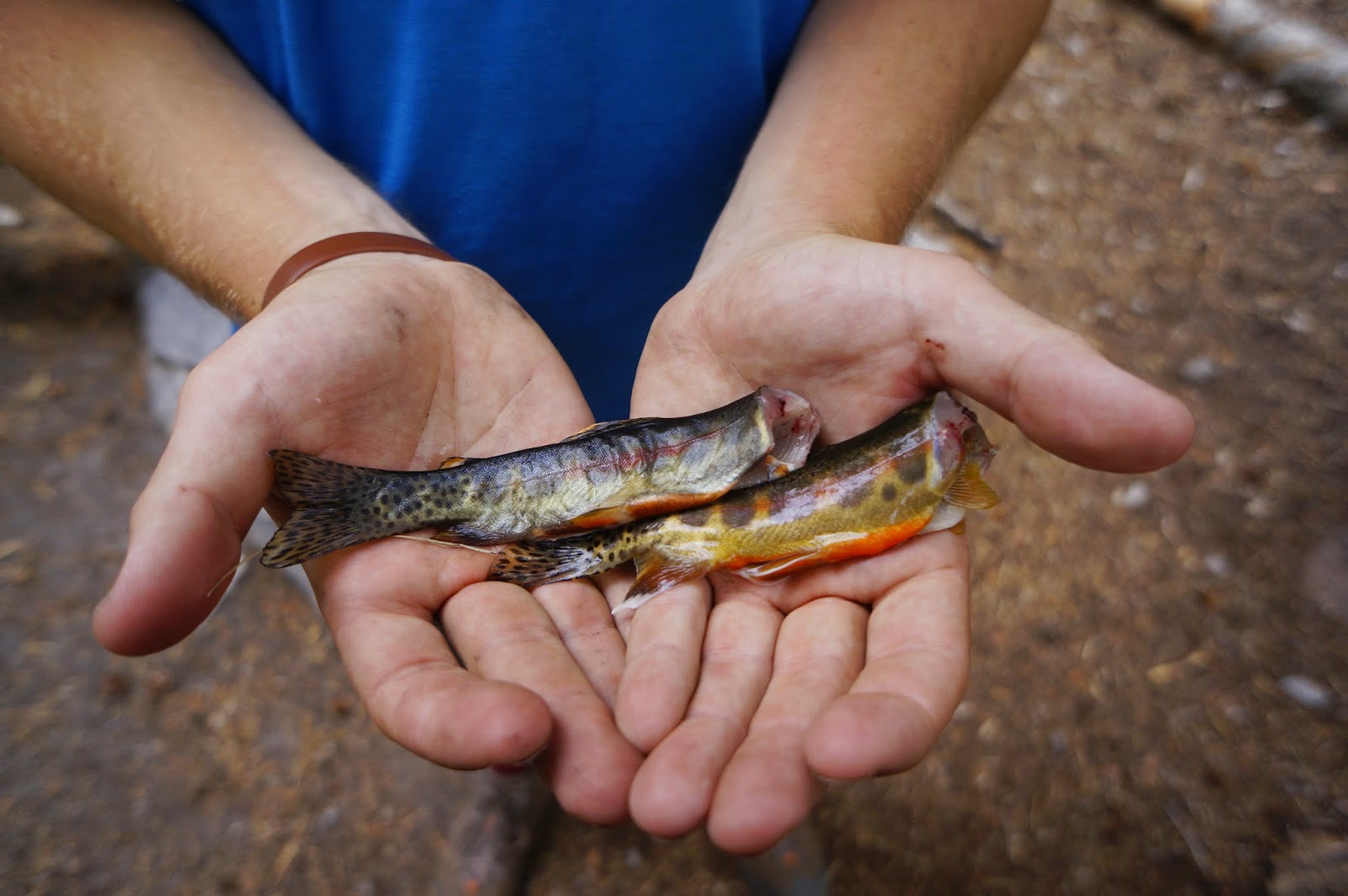 |
| Two bite-sized trout |
Being around them often made me feel a bit like a circus freak:
Xavier: "You fish?"
Me: "Yep, sorta."
Xavier: "You know how to gut fish?"
Me: "Yep."
Ryan: "And you hike and stuff."
Me: "All the time."
Ryan (looking at me suspiciously): "You sure you're a girl?"
Me: "You need to get out more."
They made a fire and did a great job creatively cooking the fish over the coals, and we ate them with our bare hands like a bunch of filthy, stinking savages. Which at that point, 6 days into it, we actually were.
 |
| Creative campfire cooking with the melted plate |
The rest of the day was a long hike through the woods. There were pretty wildflowers, lots of deer, some marmots, tons of ground squirrels, chipmunks, birds, and some beautiful waterfalls, and even a lizard. But after the Punch You In the Face Wow scenery of the high mountains, it was kind of the visual equivalent eating high quality but bland food.
 |
Lizard. Ironically, I took this photo because I was stunned
at what a gorgeous bright blue he was.
And forgot I still had my camera set to B/W from a previous photo. |
 |
| Waterfall at the Road's End trail junction |
It was mid-afternoon by the time I made it to the Bishop Pass Junction, about the earliest I thought Jeannie might make it there, so I wasn't too surprised when I didn't see her sitting there. There were, however two guys: Ryan and Xavier's friends who were bringing them a much-wanted resupply. I chatted with them briefly and asked if they had seen my sister: "Did you see a cute blonde girl?" "Um, yeah, she was all ready to go swimming, could that have been her?" Then they described her as "kinda edgy-looking" which made me think they hadn't seen her because Jeannie isn't what I'd describe as edgy. But apparently it was her and I'm just used to her and think she's cute and a total stud vs. a hardcore edgy punk siren. Or maybe it was just because they were Mormon?
Regardless, I left my backpack minus a few key things and a poncho with the boys and hiked up to see if I could find her and help her carry stuff. Sure enough, about a mile up the trail there she was! In her bright pink shorts and cute top and aviation glasses. But without a pack. She explained that after hauling her monster pack all the way up the pass, her hips had started to really hurt, so she dumped the pack and had brought down just my resupply. We decided to drop some of the stuff back down the trail with the guys and then hike up to where she had left her stuff to spend the night.
Both of us had already had a full day of hiking behind us, hers a lot harder than mine, so hauling our butts the 3.5 miles (and 2050 feet of climb) back up the hill to Dusy Basin was a struggle, but a deer led the way, and we chatted the whole way up which made it less of a slog. It was the first time I'd really been able to spend time with her since we met up in Argentina, and it was great to talk to her.
 |
| The deer who escorted us up the trail to Dusy Basin |
We got to her camp, and I sifted through the resupply to cull what I wasn't going to need (like almost half of the food since my appetite wasn't letting me eat nearly as much as I was supposed to be eating) while Jeannie made an elaborate and crazy delicious tortilla soup from a bunch of fresh ingredients she had hauled up. Her pack must have weighed 50+ pounds with all of her gear, all of my resupply, plus the elaborate dinner-makings. My sister is a total stud (and a saint for hauling that stuff up to me).
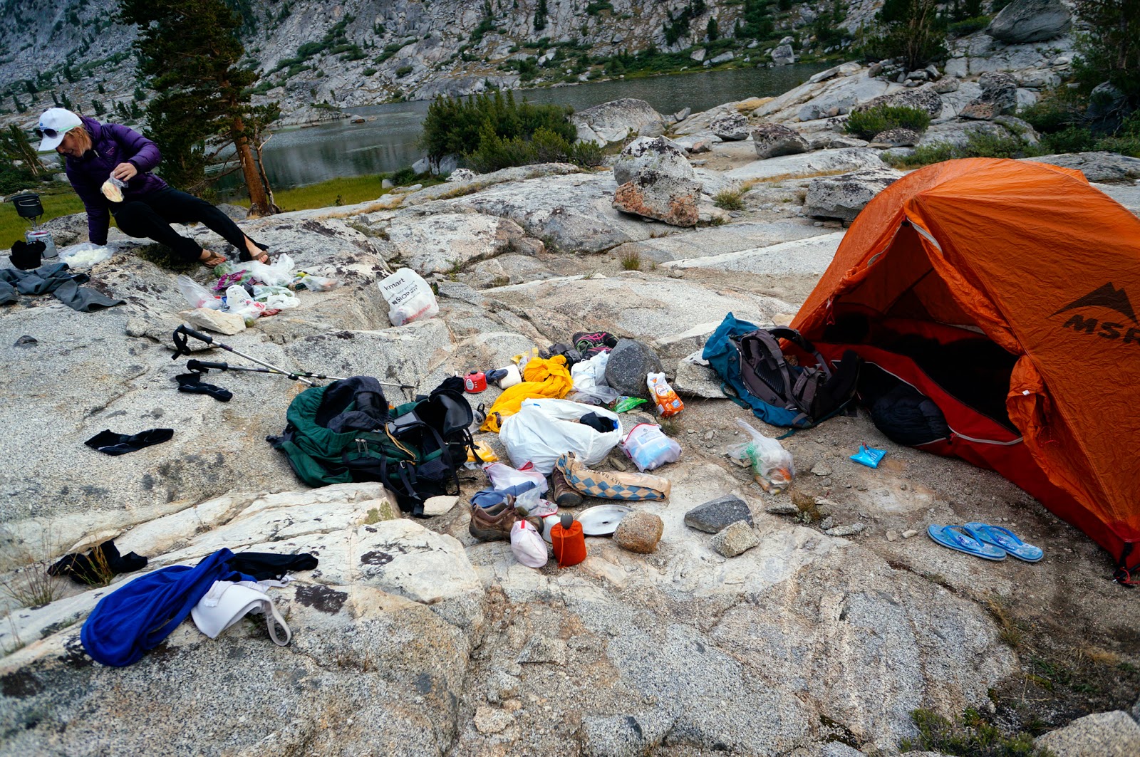 |
Sorting through the stuff Jeannie hauled up
while Jeannie cooks dinner in the background |
Then she pulled out the wine glasses and the box of wine. I laughed, "No wonder you're hurting! But YES PLEASE!!" We polished it off while watching the sun set, talking about love and life and work and how both of us have our spiritual center in the mountains.
"God is in the mountains," remarked Jeannie, "when I see them, it makes me believe again."
 |
| <3 Sister time! <3 |
We only had one sleeping bag between us, and we snuggled into her tent head to foot with the unzipped bag splayed out on top of us to stay warm. It was cold. And Jeannie had what was probably altitude sickness and spent part of the night puking. Poor kid. And then the lightning storm hit. It was a rough night. But still quality sister time! It was great.
 |
| Sunset over Jeannie's tent (I actually slept in a tent!) |
The rain lasted the rest of the night and was still going strong when her alarm went off in the morning. We made the smart call to go back to sleep. A few minutes later, there was a break in the deluge, and we scrambled to get out, pack up, and get moving before the clouds broke again. I was sad to say goodbye, my sister is my favorite hiking buddy and it had been great seeing her, but she works like a normal responsible person. She tried to convince me to quit the trail, but I was having way too much fun to leave the mountains. So, alas, we hugged goodbye and I sent her down the trail with an old and kind of bizarre (but nice) hippy who was having something of a panic attack for worry about his wife, and she had offered to drive to Mammoth.
Back I went down the trail to return to the JMT, now loaded up with a resupply for the second leg of the journey.
 |
| Bye Jeannie! |
Like the photos? There are more in the
Photo Gallery, and more will be added every day as I sift through them all...there are a lot!